Site investigations are fundamentally about identifying anomalies in the ground that, if left unidentified, could add considerable cost to a project.
It is therefore crucial that site investigations are planned with the project in mind, to ensure engineers’ understanding of what is going on below ground is as complete as possible.
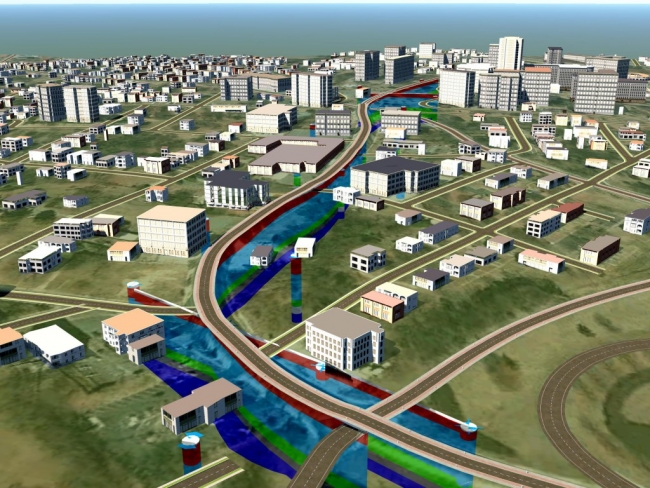
One answer is use geotechnical BIM. Its ability to compile and visualize data from a variety of sources at the desk study stage (including project plans), ensures field work is appropriate and builds upon previous knowledge.
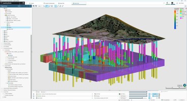
BIM can deliver comprehensive 3D ground models and allows multiple sections to be drawn quickly (and inexpensively), enabling any potential issues to be identified and viewed from multiple angles, reducing project risk. Anomalies can also be more easily visualized by non-geotechnical professionals (including the client and other stakeholders), enabling them to fully understand how problems in the ground could affect the project.
“Being able to use rendered images and fly-throughs of models is a real bonus, as the client can visualize the design and have far more input in the process,” confirms Wardell Armstrong Technical Director Chris Smith. “We can make real-time changes to the model and explore different options to see how this would affect construction costs.” Geotechnical BIM can clearly save money at the desk study and investigation stages but these savings are relatively small when compared with potential overall project savings, should a ground-related problem be discovered.
Read the full article for more information here , where you can also register for a free webinar on the benefits of Geotechnical BIM and download the Geotechnical BIM Cost Calculator
Want to read more like this story?

Eurocode's Ground Model Revolution: A New Era in Geotechnical Engineering
Dec, 25, 2024 | NewsThe Ground Model, as defined by the 2nd generation Eurocode 7, serves as a "site-specific outline o...

Leapfrog Works
Dec, 29, 2022 | SoftwareOther Geotechnical
Jun, 04, 2019 | Education

Keynetix leads significant BIM for the subsurface Project; expected to be completed in 2017
Jun, 10, 2015 | NewsA cloud-based database of UK geological and geotechnical data and 3D ground models could soon become...

Uncovering the Hidden Benefits of Buying New Software
Apr, 03, 2017 | NewsTechnology has moved on a great deal in the last five years and clients are increasingly demanding...

YII 2020 - ACCELERATE Digital Cities Webinar Series: OpenGround, from Ground to Cloud
Oct, 27, 2020 | NewsEnsure that your project starts on solid ground from planning and analysis to operation. Deliver ge...
Brownfield success: Engineering excellence starts below ground
May, 06, 2026 | NewsWhy environmental and geotechnical teams must unite data and work as one to better manage risks in b...

How geotechnics can make life simpler, safer and more certain for infrastructure projects
Dec, 10, 2021 | NewsFor any transportation project it’s essential to have a clear view of the subsurface and any proble...

New UK bill aims to unlock geotechnical data and save billions in infrastructure projects
Mar, 04, 2026 | NewsA new legislative proposal in the United Kingdom aims to transform how geotechnical and ground inve...
Form
Looking for more information? Fill in the form and we will contact Bentley for you. Alternatively, you can visit Bentley's website and speak with a Bentley Geotechnical Expert.
On This Day
July 15th 1894
READ MORE
Related Video

Trending

Quick Clay Failure on Norway’s E6 at Levanger

Keller North America announces recent leadership changes

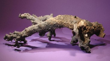
Fulgurite: A rare phenomenon
Asbestos remains a deadly infrastructure risk across the UK

Major earthquake in southern Philippines causes deaths and widespread damage