News
Featured News


Visualization News

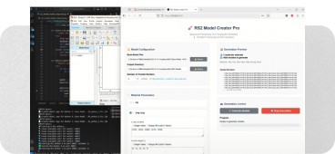
Understanding Watermarks in Student Licences for PLAXIS and GeoStudio
- Mar, 05, 2026
- Numerical & Constitutive Modeling Finite Element / Finite Difference News On Software News On Projects / Industry Slope Stability Visualization Soil Structure Interaction
- Authored by: Geoengineer.org
GeoStudio and PLAXIS are two of the most widely used software solutions in geotechnical engineering, providing powerful tools for slope stability, seepage, deformation, and soil-structure interaction...
Read More
Dewatering example on a specific deep well system with GeoStudio
- Feb, 13, 2026
- Deep Excavations Groundwater & Seepage Groundwater Pumping Visualization News On Software News On Research / Academia
- Authored by: Geoengineer.org
The objective of dewatering is to lower the groundwater table to prevent significant groundwater flow into an excavation, and/or to ensure slope stability. The preferred dewatering system will depend...
Read More
Antarctica’s subglacial world revealed in unprecedented detail
For decades, Antarctica’s ice surface has been mapped in remarkable detail, yet the terrain beneath remained one of Earth’s least understood landscapes. That gap has now narrowed significantly. Using...
Read More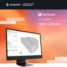
New Release: GeoStudio 2025.2
- Dec, 04, 2025
- Numerical & Constitutive Modeling Data Management Visualization Slope Stability Analysis News On Software
- Authored by: Geoengineer.org
GeoStudio 2025.2 makes modelling more accurate, automation easier, and the software accessible to more users worldwide. It introduces a 3D Sweep Option, improvements to the GeoStudio Python scripting...
Read More
Vienna metro 3D model now spans half the city
- Nov, 26, 2025
- Tunneling Visualization Data Management News On Projects / Industry News On Software
- Authored by: Geoengineer.org
Discover how cutting-edge geological modelling is guiding Vienna’s metro extension from concept to construction, helping bridge uncertainties and build client trust. At this year’s World Tunnel Congr...
Read More
Building the Future Underground: Implementation Strategies and What’s Next
- Oct, 30, 2025
- Data Management Visualization Numerical & Constitutive Modeling News On Software
- Authored by: Geoengineer.org
The implementation of digital twins isn’t simply about adopting new software tools. It requires developing a new way for how different disciplines communicate and collaborate. This process consists o...
Read More
Digital twins underground: The paradigm shift from static models to living systems
Digital twins have revolutionized projects in engineering circles for years, but its application to the subsurface realm represents a new way of thinking. The best way to understand the underground i...
Read More
The Underground Challenge: Why Traditional Tunneling Approaches Are Failing
- Oct, 27, 2025
- Tunneling Data Management Visualization Numerical & Constitutive Modeling News On Software
- Authored by: Geoengineer.org
Going underground is a seemingly simple approach to addressing the increasing pressure for infrastructure in our fast-growing societies—but it is far from simple. Tunneling can carry enormous costs p...
Read More
Risk Management in Mining: The Importance of Geotechnical Analysis
- Apr, 01, 2025
- Tailings Dams Visualization Geoenvironmental Engineering Slope Stability News On Research / Academia
- Authored by: Geoengineer.org
Geotechnical analysis involves studying the physical properties of soil and rock to determine their behavior under stress, which is crucial in mining environments. This analysis supports constructing...
Read More
45% of Himachal Pradesh at Risk of Landslides and Floods – What Can Be Done?
- Feb, 19, 2025
- Landslides Engineering Geology Visualization Risk & Reliability Geomatics News On Research / Academia News On Natural Disasters / Failures
- India
- Authored by: Geoengineer.org
A recent geospatial study has revealed that over 45% of Himachal Pradesh is highly susceptible to landslides, floods, and avalanches. Researchers conducted hazard mapping to identify high-risk zones...
Read More