Eurocode's Ground Model Revolution: A New Era in Geotechnical Engineering


Sources: op.europa.eu, researchgate.net
Want to read more like this story?

Leapfrog Works
Dec, 29, 2022 | SoftwareConsiderations and Applications of FEA
Oct, 13, 2025 | EducationSetting up an FE model in geotechnical engineering is a process that requires careful consideration...

Numerical Modelling: On the Importance of an Appropriate Soil Model
Jul, 22, 2021 | EducationThe following was prepared by Dr. Ronald B.J. Brinkgreve, and first presented by Virtuosity. Numeri...
Brownfield success: Engineering excellence starts below ground
May, 06, 2026 | NewsWhy environmental and geotechnical teams must unite data and work as one to better manage risks in b...

Simplifying Complexity: Key Innovations in the Updated Eurocode 7
Dec, 09, 2024 | NewsThe evolution of construction standards in Europe has reached a pivotal moment with the introductio...

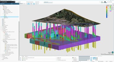
Driving better value with geotechnical BIM
Jul, 19, 2017 | NewsSite investigations are fundamentally about identifying anomalies in the ground that, if left unide...

Eurocode 7's Evolution: Enhancing Resilience with Reliability Based Methods in Geotechnical Projects
Jan, 16, 2025 | NewsThe second-generation Eurocode 7 marks a pivotal evolution in geotechnical engineering standards, i...

Designing for Safety and Sustainability: How Eurocode 7 Second Generation Shapes Retaining Structures
Jan, 26, 2025 | NewsThe second generation of Eurocode 7 introduces a pivotal evolution in the geotechnical design of re...

The importance of ground modelling in linear infrastructure design
Oct, 22, 2023 | EventWhen it comes to route planning for new linear infrastructure, understanding the prevailing ground...
On This Day
July 16th 1994
READ MORE
Related Video

Trending

Quick Clay Failure on Norway’s E6 at Levanger

Keller North America announces recent leadership changes


Fulgurite: A rare phenomenon
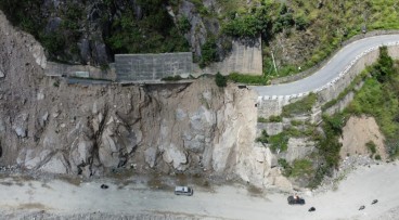
Nepal’s Himalayan settlements face escalating flood and landslide threats