Life after gINT - Rethinking geotechnical data management for a new era Sponsored
A turning point for the industry
gINT has long been the backbone of geotechnical data management. For decades, it provided engineers with a structured way to store borehole data, generate logs, and standardize reporting.
But its discontinuation signals something larger than the end of a tool. It marks a shift in how geotechnical data is expected to function within modern infrastructure projects.
As support phases out and organizations evaluate successors - often starting with OpenGround - the real question is not simply what replaces gINT, but:
What should geotechnical data management look like going forward?
What is gINT and how is it used in geotechnical workflows?
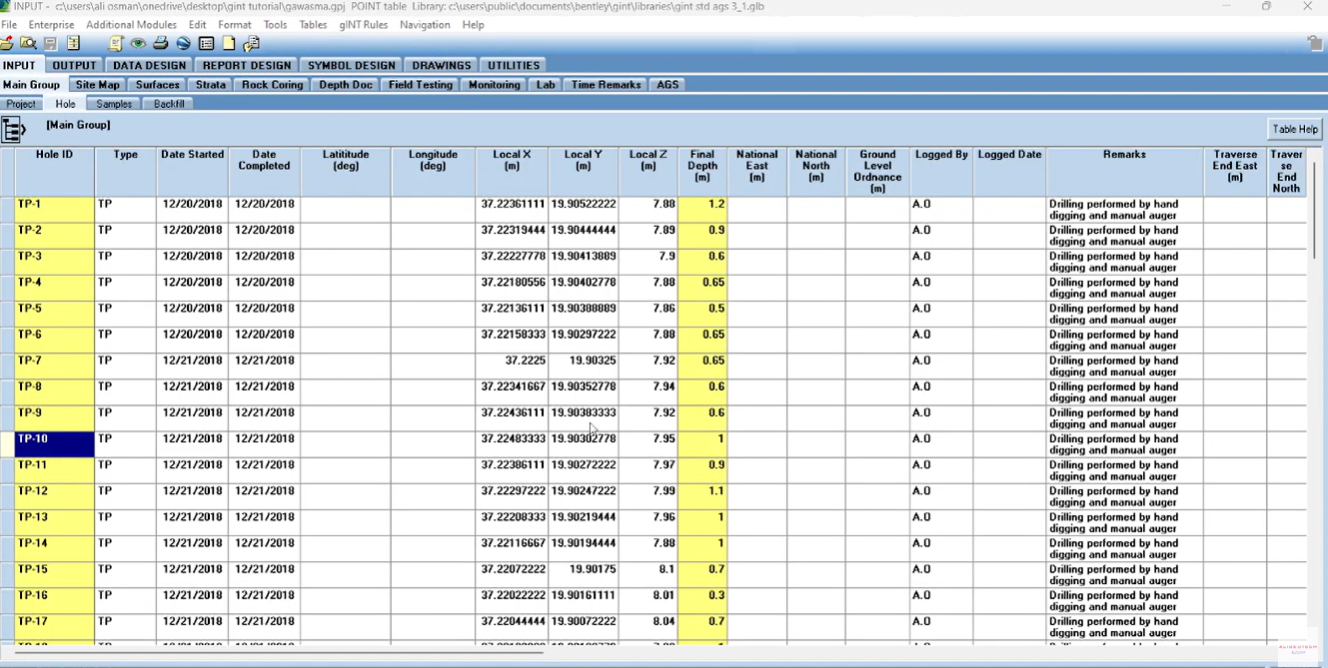
gINT is, at its core, a geotechnical data management system - a tool used to collect, store, and report subsurface data such as borehole logs, laboratory tests, and field observations.
However, it was built around a document-centric paradigm:
- Projects are stored as separate files
- Data is organized per project
- Reports are the primary deliverable
This model worked well when projects were siloed and deliverables were static. Today, that assumption no longer holds.
How does gINT compare to modern geotechnical data management tools?
Modern geotechnical data platforms take a fundamentally different approach. Where gINT is traditionally file-based and report-driven, many newer systems are designed to be:
- Database-driven rather than file-based
- Collaborative rather than isolated
- Integrated with design environments
- Data-centric rather than document-centric
This shift is subtle but important. It reflects a broader industry transition - from managing reports to managing living datasets.
What is geotechnical data management and how is it different from analysis software?
Geotechnical data management refers to the discipline of:
- Capturing field and laboratory data
- Structuring and validating that data
- Storing it in a centralized system
- Generating outputs such as logs, sections, and reports
This is distinct from geotechnical analysis tools, which perform calculations such as slope stability or settlement modeling. Modern workflows require both - but they serve different roles.
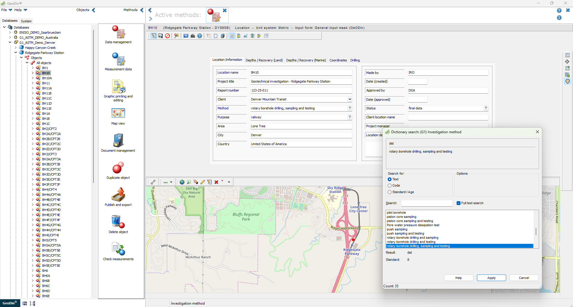
Platforms like GeoDin operate in the data management layer, acting as the foundation that feeds reliable data into downstream analysis and design tools.
Why legacy approaches are reaching their limits
The limitations often associated with file-based systems like gINT are becoming more visible. Engineering teams increasingly face:
- Fragmented datasets across projects
- Difficulty reusing historical information
- Inconsistent standards between teams
- Heavy reliance on static PDFs
These are not just software limitations - they are workflow constraints.
What is the best geotechnical data management software today?
A new model is emerging. Instead of treating reports as the final output, organizations are beginning to treat the database itself as the deliverable.
The most effective platforms are those that can:
- Collect data (field and lab)
- Store it centrally
- Standardize it across projects
- Visualize it in meaningful ways
- Report dynamically from the database
Solutions such as GeoDin are built around this full lifecycle approach - positioning the database as the single source of truth.
Which geotechnical software supports AGS 4 and international data standards?
Modern geotechnical platforms are expected to support:
- AGS 4 (UK)
- DIGGS (US)
- ASTM
- EN ISO / Eurocode
- DIN and other national standards
Platforms like GeoDin support 11+ international standards simultaneously, enabling teams to work across regions without compromising consistency.
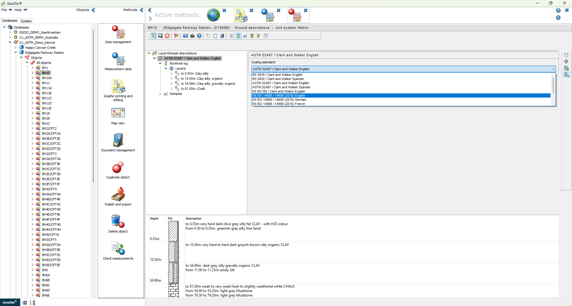
What are the alternatives to gINT and how does migration work?
A typical migration involves:
- Extracting data from legacy files (.mdb, .gpj, .accdb)
- Converting it into a structured format
- Importing it into a centralized database
- Validating data integrity
- Rebuilding reporting templates
Platforms like GeoDin support this transition through dedicated migration workflows.
Closing the gap between data and design
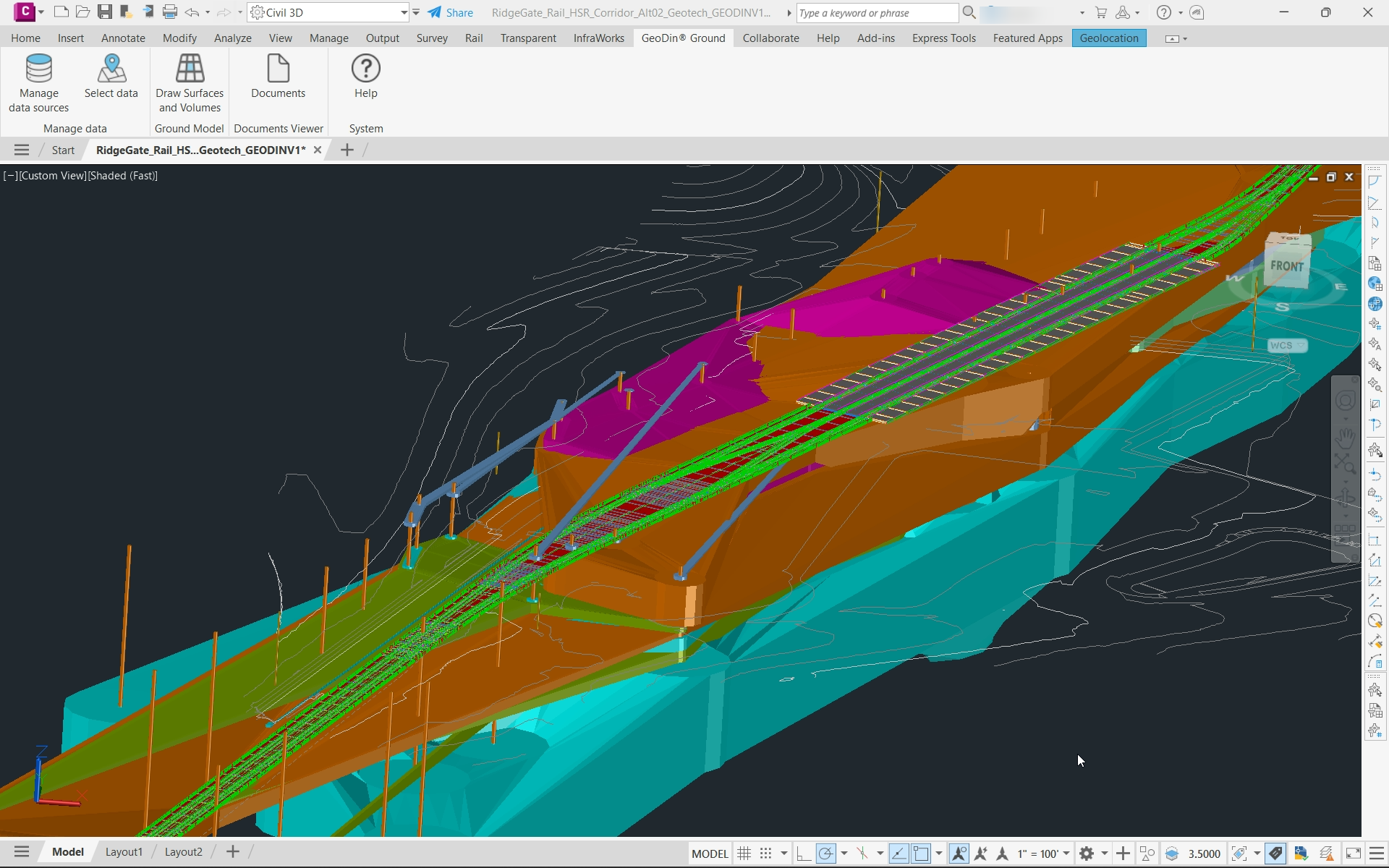
Another major shift is the expectation that geotechnical data should flow directly into design environments. Rather than relying on static reports, modern workflows enable:
- Direct access to borehole data in CAD tools
- 3D visualization of subsurface conditions
- Better alignment between interpretation and design
This is enabled through integrations such as GeoDin Ground for Civil 3D, which connects geotechnical data directly to design workflows.
Data quality starts in the field
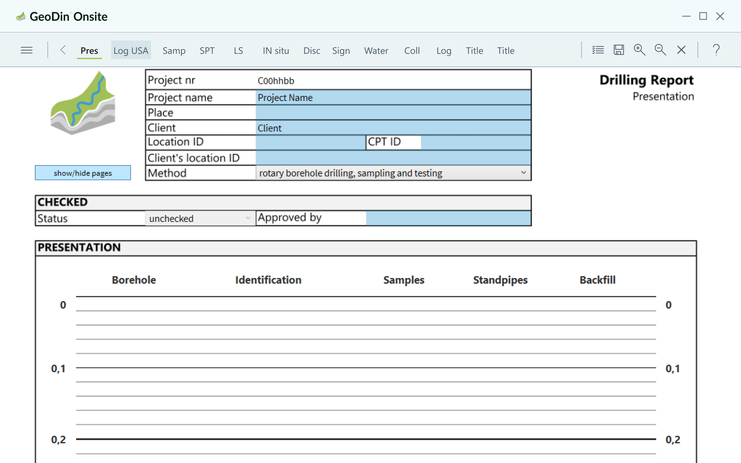
As workflows become data-centric, field data becomes the foundation.
Digital field collection tools - such as GeoDin Onsite - replace paper logs by capturing structured, validated data directly at the source and reducing downstream errors.
This shift is critical to ensuring data integrity throughout the lifecycle.
The opportunity behind gINT’s discontinuation
The end of gINT introduces disruption - but also a rare opportunity. An opportunity to rethink fragmented workflows, improve data quality at the source, strengthen collaboration across disciplines, and build scalable, future-ready data systems.
Some modern platforms - such as GeoDin - are already aligned with this direction, combining centralized data management with flexible deployment and design integration.
Looking ahead
The firms that will benefit most from this transition are not those that simply replace gINT - but those that use this moment to modernize how they manage geotechnical data.
The industry is moving toward connected workflows where data - not reports - drives decisions. Platforms such as GeoDin reflect this shift by acting as a single source of truth for subsurface information.
For organizations navigating life after gINT, the real opportunity lies not in replacing a tool, but in improving how data supports the entire project lifecycle.
Want to read more like this story?

Bentley’s OpenGround Cloud Platform: Increase the Value of your Geotechnical Data
Jul, 21, 2020 | NewsOpenGround Cloud, Bentley's secure enterprise cloud collaboration platform for geotechnical data ma...
Data Management
May, 19, 2020 | Education

Bentley Webinar | Managing Your Large Subsurface Geotechnical Data Using gINT
Sep, 29, 2021 | EventIn the current geotechnical practice, one will likely work with a large number of subsurface data,...

Mitigating Risk: Disparate Data in the Mining Industry
Aug, 12, 2024 | NewsWith operations often spread across various locations and the involvement of multiple teams, data c...

Enviro Data
Nov, 07, 2013 | Software
Going digital: US Army Corps of Engineers turns $500k into $500m data asset
Mar, 05, 2025 | NewsDataforensics unlocked incredible value for the US Army Corps of Engineers by moving subsurface dat...

Bentley Webinar: Advance your digital workflow with OpenGround
Aug, 27, 2021 | EventJoin Katie Aguilar, Application Engineer, Kyle Hao Shen, Product Advancement Engineer and Seequent...

Data-rich, insight-poor? It’s time to tame your geotechnical data chaos
May, 20, 2026 | NewsIn ground engineering, we have never generated more data. Advanced investigation techniques are crea...
gINT Software Webinar Series to Focus on Enterprise Solutions and GIS Applications - Topics to include how to improve subsurface data in GIS interface
Sep, 14, 2009 | NewsgINT Software will be hosting a series of webinars in September and in October covering a wide varie...
On This Day

Related Video

Trending

Lake Chippewa’s floating island that has to be boat-pushed every year

How to Model Piles in PLAXIS

3 Types of Retaining Walls and Revetments


How Do Dams Trigger Earthquakes?
Stop Guessing, Start Designing: Introducing Support Designer in Slide2
Development program prepares new engineers for success