Going digital: US Army Corps of Engineers turns $500k into $500m data asset Sponsored

Dataforensics unlocked incredible value for the US Army Corps of Engineers by moving subsurface data to the cloud, saving years in migration time and 62,700 work hours along the way.
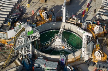
For decades, the US Army Corps of Engineers (USACE) has been gathering subsurface data essential to its operations – literally millions of linear feet of it, for thousands of projects, including dams, levees, buildings, bridges and more, scattered around the world.
Unfortunately, the number of databases in which this critical information resided was of a similar scale.
The USACE had accumulated more than 500 separate and disparate database structures, leading to increasing issues with accessibility, collaboration, interoperability and workflow.
As the problems and resulting inefficiencies mounted, USACE made the strategic decision to introduce a global standardisation for its subsurface geotechnical data management by implementing products from Seequent, The Bentley Subsurface company. USACE put OpenGround at the heart of its cloud-based enterprise data management.
The top priority was to compile and migrate all existing historical subsurface data, which encompassed borehole, laboratory testing, and in-situ testing. To say this was a huge undertaking would be putting it mildly.
Before the data could be loaded into OpenGround, it would first need to be cleaned and standardised, and that’s where the magnitude of the exercise became apparent. To do the job by hand would have likely taken years, if not decades. Geotechnical data management company Dataforensics were therefore recruited to develop a software programme that would automate as much of the process as possible, using the APIs for gINT (where much of the historic data resided) and OpenGround.

2 years: Data migration done in 2 years, 20 times faster than manual estimates.
$500M ROI: Spend of $500k transformed USACE into $500m asset.
62,700: number of hours saved by going digital.
Apart from giving USACE vastly improved access to its data, and the ability to extract greater value from it, the shift to OpenGround enhanced operations in a number of other ways, such as improved collaboration between offices and contractors.
Going digital allowed USACE to unlock a tremendous asset and improve the quality of their subsurface data.
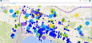
Interoperability was improved, with data now more easily integrated into software such as Civil3D, Leapfrog Works, GeoStudio and GIS platforms. In particular, the ability to import borehole information into the same platform as geophysical data (in Leapfrog) and a variety of other data (in GIS) greatly improved workflows and the ability to visualise data sets together.

Bringing every district under the single roof of a standardised database structure
USACE had been primarily using gINT software to manage their borehole data. However, there was no standard in place and each of the district offices was managing their information on separate servers with their own formats and reports.
Shifting to an enterprise level cloud solution allowed USACE to implement a standard database structure across all districts and projects.
Hunting for anomalies and correcting typos
To improve the quality of the data, Dataforensics addressed several issues. This included correcting typographical mistakes in date values, fixing data types in scenarios where numeric values were stored in text fields in gINT, and ultimately standardising vast quantities of gINT data. Additionally, there were numerous soil properties from lab test results such as soil classifications, or interpreted results from particle size distribution tests, which were shown on gINT reports, but not actually stored as data in the database.
The successful seven-step solution was:
- Organise the files into similar database structures that could all be migrated at the same time.
- Generate PDF log reports for each gINT project using the gINT API.
- Setup a data cleanup/conversion template for each set of similar database structures.
- Perform calculations that are often reported in gINT but do not exist in the gINT database.
- Convert to an OpenGround compatible data format.
- Upload data to OpenGround using the OpenGround API having automatically identified the coordinate system.
- Upload PDF documents of gINT logs to OpenGround using the OpenGround API.
All but step 3 – which required a geotechnical data specialist competent in gINT and OpenGround – were run autonomously with human oversight to check each step had been completed successfully. Left to a human without autonomous support, Dataforensics calculated that it would have taken 20 times as many hours to reach the end of the task, a saving of 67,000 hours in total.
Moving on from ‘how we’ve always done it’
Going digital and having all subsurface data in a single enterprise database (OpenGround), has helped USACE unlock the true value of a powerful asset.
The improvements in efficiency of personnel using a standardised geotechnical data management system, plus the associated cost and time savings, are substantial. USACE can collaborate more effectively across the supply chain, which saves work hours and increases productivity.
Having this information easily available in OpenGround means teams can more quickly leverage historical data to reduce risk in ongoing projects, and lessen carbon footprint by avoided re-drilling boreholes at the same locations.
USACE must also deal with critical geotechnical and geological questions that require rapid answers. The ease with which OpenGround allows the access and sharing of information has accelerated the USACE’s responses (for example, once giving within minutes the advice the Air Force required about boreholes near an area they were operating).
Standardised data from contractors means that USACE now gets all the data required for contractors to complete their investigation projects so the datasets they are receiving are more complete (e.g. they include boreholes, lab testing and in-situ testing data), available in a format they can reuse, and extract additional value from in the future.
OpenGround is speeding up the way teams can utilise data in other systems such as AutoCAD Civil 3D, Leapfrog, GeoStudio, PLAXIS, and Excel which means subsurface conditions on their sites can be evaluated more quickly, and robustly with data driven decisions made more confidently, accurately and rapidly.
This article is from 2025 Special USA and Canada Geotechnical Business Directory edition, available as an e-book and in-print, and will be distributed for free during the Geotechnical Frontiers 2025 through ARGO-E GROUP’s booth.
Want to read more like this story?

Bentley’s OpenGround Cloud Platform: Increase the Value of your Geotechnical Data
Jul, 21, 2020 | NewsOpenGround Cloud, Bentley's secure enterprise cloud collaboration platform for geotechnical data ma...

Life after gINT - Rethinking geotechnical data management for a new era
Mar, 26, 2026 | NewsA turning point for the industry gINT has long been the backbone of geotechnical data management....
OpenGround case to improve analysis, be more competitive, and increase value
May, 31, 2022 | NewsGeotechnical consultant CMW Geosciences’ complete transition to OpenGround by January 2020 was incr...

Bentley System announces availability of OpenGround Cloud: The secure, cloud-based collaboration platform for geotechnical data management
Sep, 17, 2020 | NewsBentley Systems, Incorporated, has announced the availability of OpenGround Cloud, a new cloud serv...

Bentley Webinar | Managing Your Large Subsurface Geotechnical Data Using gINT
Sep, 29, 2021 | EventIn the current geotechnical practice, one will likely work with a large number of subsurface data,...

Mitigating Risk: Disparate Data in the Mining Industry
Aug, 12, 2024 | NewsWith operations often spread across various locations and the involvement of multiple teams, data c...

ACCELERATE: Going Digital with OpenGround
May, 26, 2020 | EventRegister for free to Bentley's upcoming webinar to learn more about OpenGround, a collection of geo...
gINT Software Webinar Series to Focus on Enterprise Solutions and GIS Applications - Topics to include how to improve subsurface data in GIS interface
Sep, 14, 2009 | NewsgINT Software will be hosting a series of webinars in September and in October covering a wide varie...

Enviro Data
Nov, 07, 2013 | SoftwareForm
Looking for more information? Fill in the form and we will contact Seequent, The Bentley Subsurface Company for you.
On This Day
July 16th 1994
READ MORE
Related Video

Trending
Seven Frequently Asked Questions about Helical Piles

Block caving: A new mining method arises

Categories of isolated foundation footings
Maharashtra's longest road tunnel to be completed soon

Carnian Pluvial Episode: That time when it rained for 1-2 million years
Emergency ground stabilisation protects rail works near Salford Central