Subsurface Risks in Renewable Energy Mega-Project of Nullarbor Plain


Sources: theguardian.com, abc.net.au, theconversation.com
Want to read more like this story?
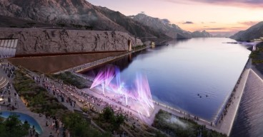
Trojena 4.7bn NEOM reservoir project stopped, leaving partial geotechnical and hydraulic challenges
Apr, 10, 2026 | NewsThe artificial lake and dam project at Trojena, part of Saudi Arabia’s NEOM development, has reporte...

Geotechnical Engineering 2032 Boom: Trends, Challenges, and Emerging Opportunities
Mar, 03, 2025 | NewsGeotechnical engineering is at the core of modern infrastructure, ensuring the stability of buildin...

Laying the Groundwork for Renewable Energy in Orkney’s Remote Terrain
Feb, 20, 2025 | NewsThe Orkney Islands are taking a significant step towards renewable energy expansion, with critical...

Large sinkhole opens in Mexico near a house
May, 30, 2021 | NewsA massive sinkhole that threatens a house suddenly emerged in Mexico. The sinkhole opened in a fiel...

Sand, Water, and Collapse: The Geotechnical Puzzle of the Godstone Sinkhole
Feb, 21, 2025 | NewsA massive sinkhole in Surrey’s Godstone High Street has triggered urgent investigations into its ca...

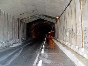
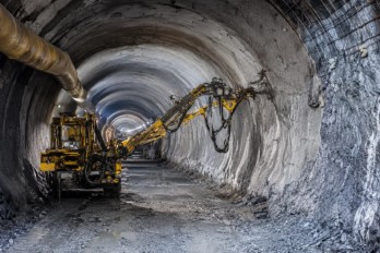
Building Tunnels Responsibly: A Dual Approach to Risk
Jun, 27, 2025 | NewsAs we live in an era where tunnelling and underground technologies are rapidly gaining traction wor...

Brownfield success: Engineering excellence starts below ground
May, 06, 2026 | NewsWhy environmental and geotechnical teams must unite data and work as one to better manage risks in b...

Geoengineers to enhance offshore development capabilities
Jun, 27, 2018 | NewsMarine and engineering consultancy LOC Renewables has invested in geological and geotechnical servic...

New UK bill aims to unlock geotechnical data and save billions in infrastructure projects
Mar, 04, 2026 | NewsA new legislative proposal in the United Kingdom aims to transform how geotechnical and ground inve...
On This Day

Related Video

Trending
Seven Frequently Asked Questions about Helical Piles

Block caving: A new mining method arises

Categories of isolated foundation footings
Maharashtra's longest road tunnel to be completed soon

Carnian Pluvial Episode: That time when it rained for 1-2 million years
Major wastewater tunnel procurement begins in southern Sweden