Satellite Technology and AI: The Future of Dam Monitoring and Disaster Prevention


Sources: .wsp.com, spectrum.ieee.org
Want to read more like this story?

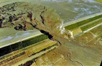
Space-Based Insights: Early Signs of Kakhovka Dam Collapse Detected
Dec, 20, 2024 | NewsThe collapse of the Kakhovka Dam in Ukraine on June 6, 2023, was a catastrophic event that devastat...

Satellite data indicate over 2,500 U.S. dams are in poor condition
Dec, 21, 2025 | NewsDams across the United States are aging and underfunded, with geoscientists reporting that over 2,5...

Michigan dam failures raise concerns about United States deteriorating infrastructure
May, 19, 2020 | NewsOn May 19, 2020, two dams in Michigan breached causing extensive flooding and infrastructure damage...

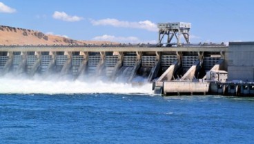
Dam Engineering
Apr, 10, 2020 | EducationA dam is an infrastructure system that consists of several structures with the intent to collect,...
May 31st is National Dam Safety Awareness Day in America
May, 31, 2016 | NewsOn the May 31st we commemorate the significant role dams play in American life. From providing nearl...

Savings in removing over repairing dams
Jul, 09, 2018 | NewsDam removal has become a mainstream option for dam safety management restoring river, coastal ecosys...
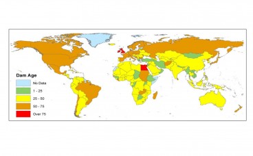
Aging dam infrastructure: A severe future threat
Jan, 22, 2021 | NewsAccording to a new report, issued by the United Nations University, aging water storage facilities...

The Dam of Stratos
May, 10, 2019 | EducationConstruction: Started in 1981 and ended in 1988. Length of the crest: 1900m Height: Small height...
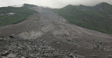
Can satellites be used as an early warning system for landslides?
Aug, 04, 2017 | NewsA joint team of researchers from Newcastle University (UK), Chengdu University of Technology, Tongji...
On This Day

Related Video

Trending

Tiebacks vs. soil nails: Choosing the right earth retention solution
When Dams Fail: The Growing Crisis of Tailings Management
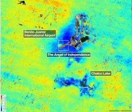
Mexico City’s sinking crisis mapped by next-generation satellite
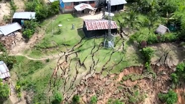
Landslide in Northern Peru Forces Evacuation of Over 170 Residents
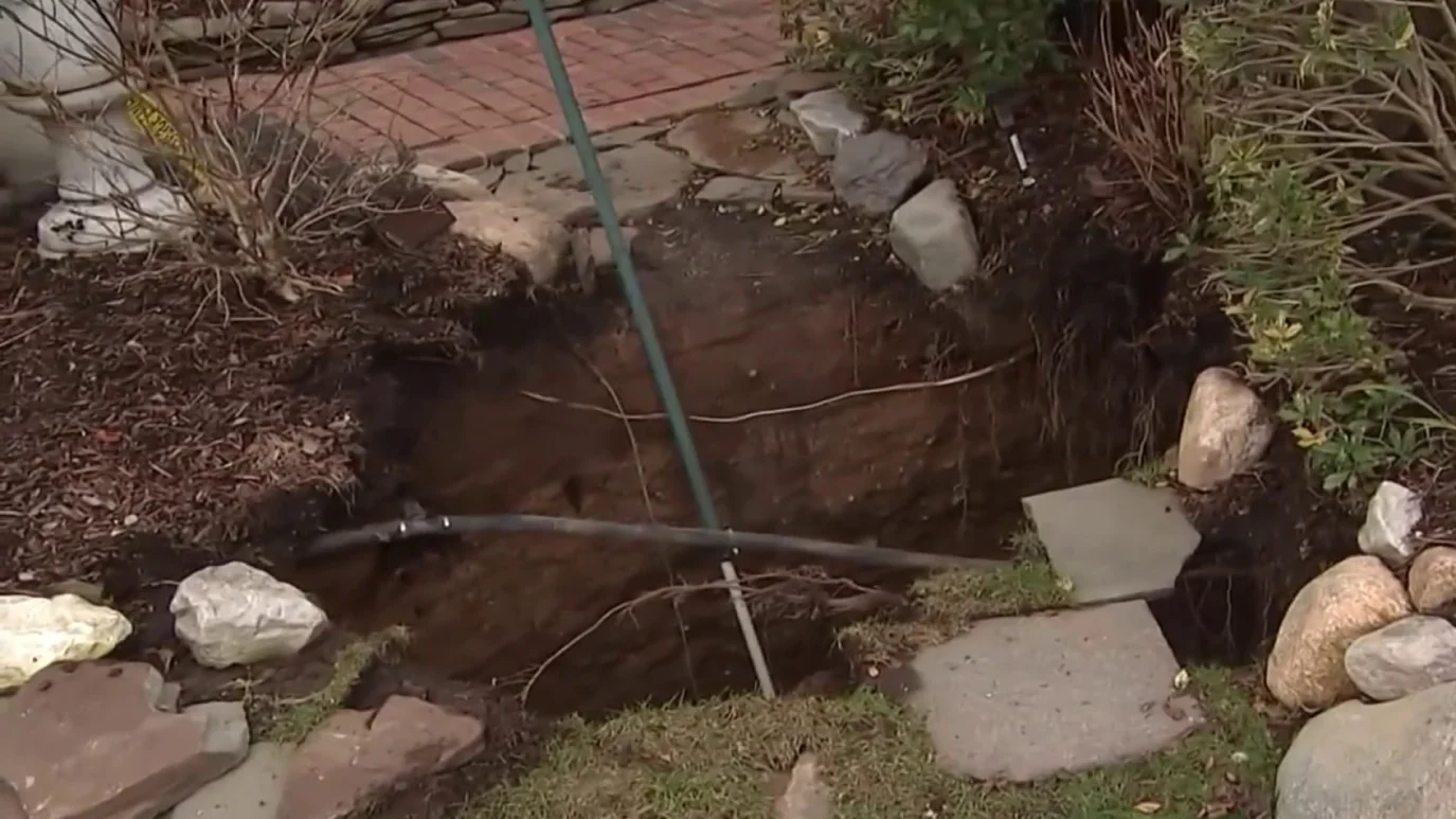
Sinkhole outside home in Huntington Station, on Long Island: 3 fall into
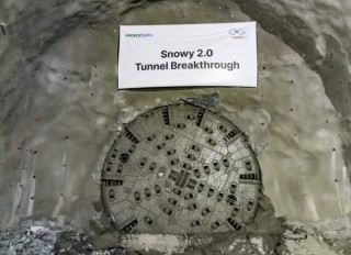
Tailrace tunnel breakthrough advances Australia’s largest renewable project
A Legacy of Leadership, Mentorship & Service: Gary L. Seider P.E.