Drones and AI Data: How Hong Kong Is Advancing Landslide Prevention

- Monitor slope conditions in real time,
- Track post-rainfall changes for rapid risk evaluation,
- Assist in creating digital terrain models, and
- Support emergency assessments in inaccessible areas.

Sources: chinadailyhk.com, scmp.com
Want to read more like this story?

AI-enhanced landslide model ready for 2026 deployment in Hong Kong
Oct, 14, 2025 | NewsHong Kong’s Geotechnical Engineering Office (GEO) has introduced a new AI-powered landslip warning...

Slope Stability
Jun, 02, 2019 | EducationA slope is an inclined ground surface which can be either natural or human-made. Slope stability...
Slope Stability Analysis
Jun, 02, 2019 | EducationAssessing a slope’s stability is a challenging yet important aspect of civil engineering. In its...

Saturated Slopes and Flash Floods: Hazards in the Himalayas and Caucasus
Aug, 05, 2025 | NewsRecent weeks have seen intense rainfall triggering destructive mudslides in two mountainous regions...

Rainfall saturation triggers deadly hillside collapses in Ethiopia
Mar, 13, 2026 | NewsAt least 102 people have been killed after a series of landslides and floods struck the Gamo Zone i...
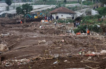
Dozens missing following deadly landslide in West Bandung
Jan, 24, 2026 | NewsAuthorities in Indonesia are continuing large-scale search and recovery operations after a major la...

Slope (Oasys)
Nov, 06, 2013 | Software
Mechanics of Slope Stability
Mar, 19, 2021 | EducationDefinition of Factor of Safety Slope stability is controlled by 2 main factors: the driving and...

Real time warning system for landslides
Aug, 09, 2018 | NewsA state-of-the-art system that is capable of warning people before landslides occur will be installe...
On This Day

Related Video

Trending

China's Three Gorges Dam under pressure: Flood hazard downstream

Functional requirements of foundation structures


Landslide in Papua New Guinea: At least 12 people dead

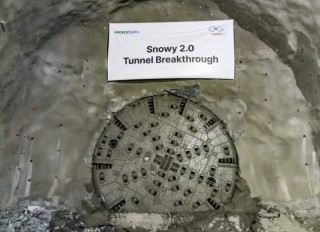
Tailrace tunnel breakthrough advances Australia’s largest renewable project

A Legacy of Leadership, Mentorship & Service: Gary L. Seider P.E.