AI-enhanced landslide model ready for 2026 deployment in Hong Kong

Hong Kong’s Geotechnical Engineering Office (GEO) has introduced a new AI-powered landslip warning system designed to predict slope failures with unprecedented precision. The fifth-generation platform integrates artificial intelligence and big data to boost landslide forecasting accuracy from about 70 percent to over 90 percent, representing the most advanced upgrade in the city’s slope safety history.
The system, scheduled for full operation in 2026, was presented at a media briefing on October 14, 2025 by Raymond Cheung Wai-man, head of the GEO, and Edward Chu Kei-hong, senior geotechnical engineer focusing on slope management. The new model employs machine learning trained on 380 historical rainfall events linked to documented landslides between 1996 and 2023, refining correlations between rainfall intensity, slope geometry, and landslip occurrence.
The AI engine draws on an extensive dataset that includes 22 million slope data points, 2,700 recorded landslip reports, and characteristics from 60,000 man-made slopes. By fusing this database with real-time meteorological and geotechnical monitoring, the system continuously updates forecasts and generates landslide probability maps every five minutes through a custom operational dashboard.
During field trials held through April and May 2025, the system underwent dynamic live testing during the rainy season. According to Chu, the results demonstrated reliable early detection of risk zones and accurate prediction of reported landslides. Ongoing optimization aims to enhance temporal resolution and minimize false alarms before full-scale implementation.
Cheung emphasized that the AI’s continuous-learning capability will allow the model to improve autonomously as new rainfall and slope performance data are added. The GEO plans to explore additional machine learning algorithms to strengthen the system’s predictive power and adapt to changing rainfall patterns driven by climate variability.
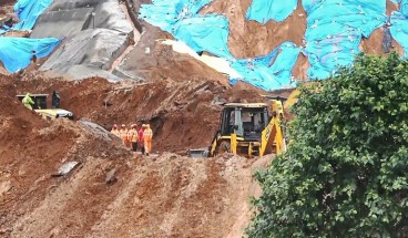
Hong Kong’s topography—with dense urban development adjacent to steep slopes—makes it particularly prone to rainfall-induced landslides. The city’s geotechnical warning infrastructure was first established after the 1972 Sau Mau Ping and Po Shan Road landslides, which killed 138 people. In 1977, Hong Kong became the first jurisdiction globally to operate a regional landslide warning system, a model later emulated in other mountainous or monsoon-prone regions.
Over nearly fifty years, the GEO’s warning framework has evolved through successive generations, integrating new monitoring data, rainfall correlations, and hazard models. The upcoming fifth-generation system adds AI-based pattern recognition and localized rainfall-slope coupling, making it the most comprehensive yet.
Cheung noted that although most fatal landslide incidents occur while general landslip warnings are already active, the new system will allow regional-level advisories for high-risk districts, enabling faster emergency alerts and targeted evacuation measures.
By 2026, the GEO expects Hong Kong’s landslide early-warning capacity to achieve near-real-time performance, reinforcing public safety and civil infrastructure resilience during severe weather events.
Source: China Daily
Want to read more like this story?

Drones and AI Data: How Hong Kong Is Advancing Landslide Prevention
Jun, 26, 2025 | NewsWith growing attention to geotechnical resilience, new technologies are being introduced to improve...
Landslides
Oct, 31, 2019 | Education

Real time warning system for landslides
Aug, 09, 2018 | NewsA state-of-the-art system that is capable of warning people before landslides occur will be installe...

Hong Kong government organises Day Camp to increase awareness on slope safety
Jul, 16, 2014 | NewsAn educational initiative aiming in introducing secondary school students to the duties of geotechni...

Risk assessment of rainfall-induced landslides in urban regions
Aug, 09, 2021 | NewsA new study suggests that urban areas are more prone to rainfall-induced landslides compared to rur...

Slope Stability
Jun, 02, 2019 | EducationA slope is an inclined ground surface which can be either natural or human-made. Slope stability...

NASA maps landslides in central America caused by hurricane Eta
Nov, 10, 2020 | NewsNASA is currently mapping the landslides that were triggered during the passage of Hurricane Eta th...
Fatal landslide exposes construction-stage risks around tunnel portals
Jul, 08, 2026 | NewsA fatal landslide at the under-construction Anakkampoyil-Kalladi-Meppadi road tunnel project in Kera...

Rainfall saturation triggers deadly hillside collapses in Ethiopia
Mar, 13, 2026 | NewsAt least 102 people have been killed after a series of landslides and floods struck the Gamo Zone i...
On This Day

Related Video

Trending

Unstable Ground: Lessons from the I-80 New Jersey Sinkhole Saga

Seequent announced extended gINT support until Dec 31, 2028

New Release: GeoStudio 2025.2


Artificial Ground Freezing: Applications, Techniques, and Key Considerations

Tailrace tunnel breakthrough advances Australia’s largest renewable project

A Legacy of Leadership, Mentorship & Service: Gary L. Seider P.E.