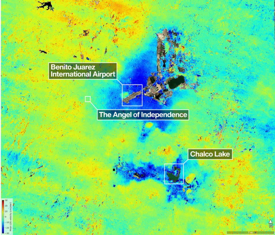
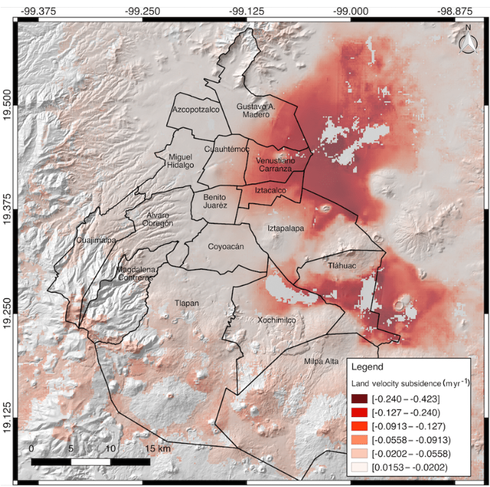
Mexico City’s sinking crisis mapped by next-generation satellite
Sources: nasa.gov, geplus.co.uk, timesofindia.indiatimes.com
Want to read more like this story?

Sinking Cities: The U.S. Subsidence Crisis
May, 26, 2025 | NewsA recent study has revealed a trend affecting the stability of American urban infrastructure: land...

Groundwater extraction causing alarming urban subsidence across India’s megacities
Nov, 04, 2025 | NewsNew research published in Nature Sustainability warns that India’s largest cities are sinking at al...

California expands groundwater and subsidence monitoring statewide
Oct, 10, 2025 | NewsCalifornia’s Department of Water Resources (DWR) has launched a major expansion of its groundwater...

The Different Types of Radars in Mining & Engineering
Mar, 24, 2025 | NewsSlope Stability Radar (SSR) technology plays a vital role in mining and engineering, offering advan...

Sinkhole swallows soda in Iztapalapa, Mexico City
Sep, 15, 2025 | NewsA truck carrying bottled soda fell into a sinkhole in Iztapalapa, Mexico City, after a section of p...

The Rising Threat of Groundwater Flooding: Risks and GeoEngineering Solutions
Feb, 28, 2025 | NewsGroundwater flooding is an often-overlooked hazard, but as climate change intensifies, its risks ar...

Powerful earthquake struck Mexico: At least one fatality
Sep, 08, 2021 | NewsAt least one person died after a M 7.0 earthquake hit southwestern Mexico on September 8, 2021. Th...

Mexico City Earthquake GEER Report Ver. 1
Oct, 17, 2017 | NewsAn intraslab subduction zone earthquake of moment magnitude 7.1 occurred on September 19, 2017 appro...

Geo-Mapping the Future: AI-Powered Solutions for Urban Liquefaction Risks
Oct, 08, 2024 | NewsAs cities expand, so does the need for robust disaster management, especially in earthquake-prone a...
On This Day
July 18th 1995
READ MORE
Related Video

Trending

Lake Chippewa’s floating island that has to be boat-pushed every year

How to Model Piles in PLAXIS

3 Types of Retaining Walls and Revetments


How Do Dams Trigger Earthquakes?
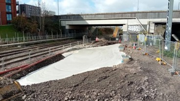
Emergency ground stabilisation protects rail works near Salford Central