Update on the massive mudslide in Washington: Aerial views of the area before and after the event, as casualties climb up to 25.
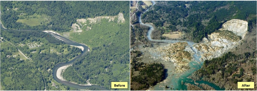
The landslide occurring early Saturday morning on March 22nd, near Arlington WA, came as a result of a period of heavy rain in the Snohomish County, which climbed up to 7.14inches, only a couple of inches lower than the wettest March ever recorded. The photograph on the left, is taken before the disaster, and shows traces of an older landslide on the top of the hill, proving that the area has experienced similar events in the past. The photograph on the right is taken shortly after the mudslide, showing the massive volume of soil that was mobilized. Namely, nearly one square mile of debris and mud went through the Stillaguamish river into the Highway 530 and the developed area, located opposite to the slope, destroying 30 or more homes. So far, 25 people lost their lives under the mud and debris in the largest landslide ever recorded in the US history and 90 are still missing.
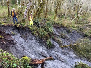
The hillside that collapsed is located in an area prone to landslides and floods, with a partial collapse of the same slope occurring back in 2006. That year, a mudslide blocked river's North Fork and the river changed course through a new channel threatening the Steekhead Drive area, the exact same neighborhood destroyed now. This time, the blocked river water is releasing some flow downstream but at a flow rate which does not raises concerns for a devastating rupture.
The state has previously taken measures to deal with the unstable slopes in the area, with the most recent major project called the Skaglund Hill Permanent Slide Repair costing the Washington State Department of Transportation (WSDOT) $13.3 million. The project secured a half-mile long part of Highway 530, west of Saturday's slide and according to WSDOT, it was initiated after a state maintenance crew discovered a "rapidly growing crack" caused by slope movement. The project included the installation of drainage pipes and the planting of trees along the slope, as well as a rock buttress between the Highway and the river.
View pictures from the site in the photo gallery below!
Source: Seattletimes
Image Gallery


Nearby News
Want to read more like this story?

Massive landslide struck north Quebec, Canada
Apr, 22, 2021 | NewsA vast landslide that occurred on April 22, is considered to be the second largest to ever hit nort...
Slow-moving landslide discovered near the 2014 Oso landslide site in Washington
Apr, 09, 2017 | NewsSigns of the landslide were first discovered on Tuesday, April 4 by Washington's Department of Trans...

Massive landslide in western India, killing 25, attributed to extensive deforestation
Jul, 31, 2014 | NewsAfter two days of incessant rain, reaching 10.8 centimeters, an entire village in Pune district...

Massive landslide buries part of California highway (video)
May, 24, 2017 | NewsPart of the mountainside went off into the Pacific Ocean, covering up a big part of scenic Highway 1...

Rainfall saturation triggers deadly hillside collapses in Ethiopia
Mar, 13, 2026 | NewsAt least 102 people have been killed after a series of landslides and floods struck the Gamo Zone i...

Massive U.K. landslide connected to deforestation of slope
Feb, 25, 2015 | NewsThe railway line connecting Banbury and Leamington Spa was blocked with nearly 350,000 tonnes of soi...

Climate change may increase landslide risk by up to 25% in the Göta river valley
Mar, 13, 2014 | NewsIncreasing landslide events in the Göta river valley, combined with future climate changes led...

Landslide swept away section of Highway 1 in California
Feb, 08, 2021 | NewsA 45-meter section of California's Highway 1 has been swept away by a large landslide. Highway 1 is...

5 years from the tremendous Oso landslide
Mar, 26, 2019 | NewsThe families of the unfortunate victims that lost their lives due to the catastrophic Oso landslide...
On This Day

Related Video

Trending

Quick Clay Failure on Norway’s E6 at Levanger

Keller North America announces recent leadership changes


Fulgurite: A rare phenomenon

Stop Guessing, Start Designing: Introducing Support Designer in Slide2
Development program prepares new engineers for success