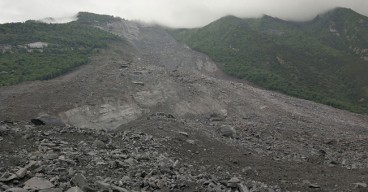
Researchers use Drones to Map Landslides in Nepal.
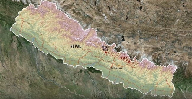
The landslides were caused by the Gorkha 2015 earthquake.
More than 20,000 landslides took place in Nepal during the Mw 7.8 Gorkha earthquake on April 25th 2015 . A youtube video describes the landslide mapping efforts of researchers from the University of Michigan (Dr. Marin Clark, and Dr. Dimitrios Zekkos), University of Southern California (Dr. Josh West) in the US and Tribhuhan University (Dr. Deepak Chamlagain) in Nepal. The research team used drones and photogrammetry principles to view map and create 3D models of large rock slides, debris flows and even rockfalls. The drone was particularly needed in this case, because of the steep topography and the large size and runout length of some of the landslides, that made it nearly impossible to map otherwise. The cool video, that was prepared by Geoengineer.org staff, is available here.
Want to read more like this story?
Landslides
Oct, 31, 2019 | Education

Videos: landslides triggered during Nepal quake caught live, drone images of destruction and CCTV footage.
Apr, 29, 2015 | NewsTwo new videos reveal the devastation caused by the magnitude 7.8 Nepal earthquake, that severely af...

Poorly Engineered Roads in Nepal Trigger Landslides
Aug, 05, 2016 | NewsThe 2016 monsoon season has been particularly severe in Nepal and has resulted in mass flooding and...
Video: NASA generated landslide map reveals most landslide prone areas!
Apr, 22, 2015 | NewsRain-induced landslides have hit a death toll of nearly 20,000 since 2007. For an overview of the la...

Earthquakes triggered by landslides
Jul, 02, 2020 | NewsIt is widely known that earthquakes can trigger disastrous landslides but, what about the opposite?...

Landslides struck Nepal: At least 11 casualties
Sep, 13, 2020 | NewsAt least 11 people have been reported dead and many more are still missing after a series of landsl...

About less deadly landslides!
Mar, 24, 2015 | NewsCould the Oso landslide have been avoided? Are there more landslide prone areas across the country a...
Can satellites be used as an early warning system for landslides?
Aug, 04, 2017 | NewsA joint team of researchers from Newcastle University (UK), Chengdu University of Technology, Tongji...

NASA maps landslides in central America caused by hurricane Eta
Nov, 10, 2020 | NewsNASA is currently mapping the landslides that were triggered during the passage of Hurricane Eta th...
On This Day

Related Video

Trending

Dubai approves $9.2bn fully underground gold line metro

How to prevent copper wire theft from light poles
The quicksand of Morecambe Bay

Model Structures and Visualize Structural Forces
Rapid Drawdown in Dam and Levee Design: A Hydrogeologic Perspective in Slide2
Tailrace tunnel breakthrough advances Australia’s largest renewable project

A Legacy of Leadership, Mentorship & Service: Gary L. Seider P.E.