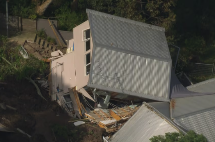
McCrae Landslide: Lessons from a Hillside Collapse


Sources: www.abc.net.au, eos.org, abc.net.au
Want to read more like this story?
Landslides
Oct, 31, 2019 | Education

Rainfall saturation triggers deadly hillside collapses in Ethiopia
Mar, 13, 2026 | NewsAt least 102 people have been killed after a series of landslides and floods struck the Gamo Zone i...
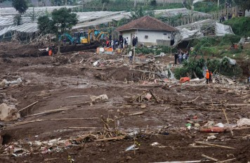
Dozens missing following deadly landslide in West Bandung
Jan, 24, 2026 | NewsAuthorities in Indonesia are continuing large-scale search and recovery operations after a major la...
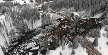
Active landslide threatens long-term connectivity in southern Bulgaria
May, 04, 2026 | NewsOne of Bulgaria’s most significant modern geotechnical failures has severed the main road between Pa...
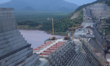
The 2019 landslide in Iran is linked with the construction of a dam
Mar, 27, 2024 | NewsIn recent years, there has been a notable increase in dam construction, driven by the growing deman...

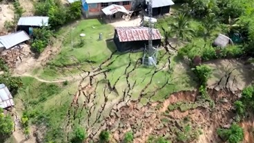
A Rotational Slide in Ecuador Leaves Communities Stranded
Mar, 30, 2025 | NewsOn March 30, 2025, torrential rainfall triggered a significant landslide near Chanazana in Nabón, E...
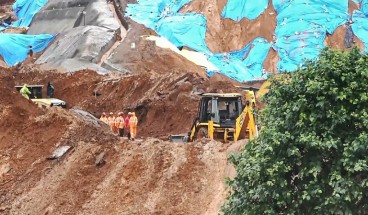
Landslide in Northern Peru Forces Evacuation of Over 170 Residents
Apr, 18, 2026 | NewsMore than 170 people have been evacuated from their homes in northern Peru following a landslide and...
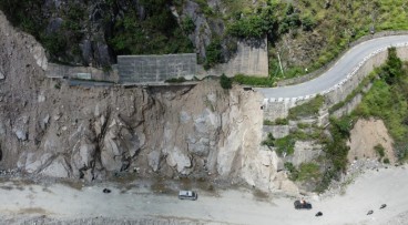
Fatal landslide exposes construction-stage risks around tunnel portals
Jul, 08, 2026 | NewsA fatal landslide at the under-construction Anakkampoyil-Kalladi-Meppadi road tunnel project in Kera...

Introduction to Slope Stability
Mar, 03, 2021 | EducationTopics on Slope Stability Analysis Geoengineer.org has gathered and presented educational mate...
On This Day
July 26th 1803
READ MORE
Related Video

Trending

Lake Chippewa’s floating island that has to be boat-pushed every year

How to Model Piles in PLAXIS

3 Types of Retaining Walls and Revetments


How Do Dams Trigger Earthquakes?
Nepal’s Himalayan settlements face escalating flood and landslide threats