A Rotational Slide in Ecuador Leaves Communities Stranded


Source: eos.org
Want to read more like this story?
Landslides
Oct, 31, 2019 | Education

Introduction to Slope Stability
Mar, 03, 2021 | EducationTopics on Slope Stability Analysis Geoengineer.org has gathered and presented educational mate...

The Mameyes, Puerto Rico, landslide, 1985
Oct, 07, 2025 | EducationThe Mameyes Landslide was a catastrophic rock-block slide that occurred at about 3:30 a.m. on Mond...

Risk assessment of rainfall-induced landslides in urban regions
Aug, 09, 2021 | NewsA new study suggests that urban areas are more prone to rainfall-induced landslides compared to rur...

Massive Landslide Found in Alaska (Video)
Jun, 28, 2016 | NewsOn Monday, a pilot in the Mountain Flying Service discovered the aftermath of a massive landslide ne...
Video: NASA generated landslide map reveals most landslide prone areas!
Apr, 22, 2015 | NewsRain-induced landslides have hit a death toll of nearly 20,000 since 2007. For an overview of the la...

Central Java landslides highlight severe slope instability
Nov, 17, 2025 | NewsHeavy rainfall across Indonesia’s Central Java region has triggered multiple landslides, resulting...

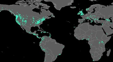
Citizen scientists at NASA’s service, for the creation of the largest landslide database
May, 24, 2018 | NewsThe aim is to get a better understanding of landslides with every report made Landslides ca...

Two landslides struck Indonesia: At least 13 casualties
Jan, 10, 2021 | NewsAt least 13 people have been reported dead after 2 major landslides struck in Indonesia. The ground...
On This Day
July 24th 2002
READ MORE
Related Video

Trending

Unstable Ground: Lessons from the I-80 New Jersey Sinkhole Saga

Seequent announced extended gINT support until Dec 31, 2028

New Release: GeoStudio 2025.2


Artificial Ground Freezing: Applications, Techniques, and Key Considerations

Major wastewater tunnel procurement begins in southern Sweden