Orica Digital Solutions Geosolutions' Unlocking operational insights for subsurface injection and production with InSAR data begins on Jul 21st 2026
Software
Orica Digital Solutions Geosolutions' Unlocking operational insights for subsurface injection and production with InSAR data begins on Jul 21st 2026
Create a free account and view content that fits your specific interests in geotechnical engineering Learn More


Data Management Software
LabSuite reduces and reports the data from sieve and hydrometer, Atterberg limits and Proctor (moisture-density) tests and automatically classify soils via USCS, AASHTO, USDA, Burmister and DOT-specif...

Use LOGDRAFT as a standalone boring log program or in concert with one or more GEOSYSTEM for Windows laboratory testing modules (Grain Size, LabSuite, Consolidation, California Bearing Ratio, R-VALUE,...

LogPlot is THE standard in log plotting software.

.
Make your instruments come to life in the palm of your hands with the MDT SMART App.

MineMonitor is a database package designed for the Mine Design Technologies SMART line of geotechnical instrumentation.
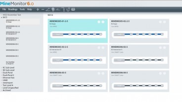
Built using the framework of our MineMonitor 6.

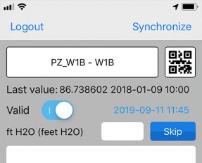
MLField® is a mobile application that is designed to bridge the gap between data collection and observations in the field, and the hosted project database.
MultiLogger Suite is the only tool you need to effectively and efficiently collect, manage, display and analyze data for a variety of project types-be it geotechnical, structrural, meteorological, env...
MultiLogger® is a Windows application designed to manage the automatic data acquisition systems (ADAS), this includes automating programming if necessary and automating data collection.