News
Featured News


Data Management News

PLAXIS, OpenGround & GeoStudio Users: Nominate Your Project for the 2022 Going Digital Awards
- Apr, 08, 2022
- Data Management Visualization Underground Structures Tunneling Soil Mechanics Slope Stability Rock Engineering Railway Geotechnics Offshore Geotechnics Numerical & Constitutive Modeling Landslides Ground Improvement Green Infrastructure Geophysics Geomatics Foundation Design / Construction Earth Retaining Structures Dam Engineering News On Projects / Industry
- Authored by: Geoengineer.org
Nominations are now open for the 2022 Going Digital Awards in Infrastructure If you used PLAXIS, OpenGround, or GeoStudio to tackle a complex geotechnical project, you can win a trip to London and...
Read More
The Evolution of Geotechnical Information Management: Why Cloud-Based Management is Growing Fast
- Apr, 05, 2022
- Data Management News On Projects / Industry News On Products & Services News On Software
- Authored by: Geoengineer.org
All earth scientists know the geological time scale. From the Archean era of the Earth’s formation billions of years ago, through the Paleozoic and Mesozoic eras of shifting land formations and bizar...
Read More
New major release PLAXIS CONNECT Edition V22.00 is out!
- Jan, 28, 2022
- Numerical & Constitutive Modeling Constitutive Modeling / Soil Behavior Finite Element / Finite Difference Data Management Foundation Design / Construction Soil Behavior Modeling News On Software
- Authored by: Geoengineer.org
PLAXIS V22 brings a major overhaul to the data structure of the material database and a more flexible and more robust way of handling project units. Due to these major changes, PLAXIS V22 will be ins...
Read More
Bentley Systems Announces License-Free Data Upload Features for OpenGround
Bentley Systems announced that the Data Upload features for OpenGround are now available to use license-free via the new upload portal. Any user with an OpenGround login, can visit the upload portal,...
Read More
How geotechnics can make life simpler, safer and more certain for infrastructure projects
- Dec, 10, 2021
- Risk & Reliability Data Management Visualization Other Geotechnical News On Products & Services News On Projects / Industry
- Authored by: George Zalachoris
For any transportation project it’s essential to have a clear view of the subsurface and any problems that may arise. What ‘lies beneath’ will invariably have a major impact on project progress and b...
Read More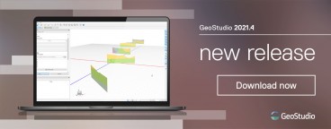
GeoStudio 2021.4 release is here
- Dec, 09, 2021
- Ground Improvement Groundwater & Seepage Data Management Numerical & Constitutive Modeling Slope Stability News On Software
- Authored by: Geoengineer.org
GeoStudio 2021.4 continues Seequent's, a Bentley company, journey to a digital twin with greater interoperability between Leapfrog geological modelling and GeoStudio geotechnical analysis. Integrate...
Read More
Bentley YII 2021 Going Digital Awards in Infrastructure: Finalists in Geotechnical Engineering Project Delivery
- Nov, 29, 2021
- Data Management Dam Engineering Engineering Geology Foundation Design / Construction Geomorphology Site Characterization & In-Situ Testing (General) Numerical & Constitutive Modeling Visualization News On Awards News On Events News On Products & Services News On Projects / Industry News On Software
- Authored by: George Zalachoris
Finalists in this industry category demonstrate excellence and significant digital advancements. Under each finalist, you will find the link to the corresponding video presentation to learn more and...
Read More
Leapfrog Works Connector Out of the Box for OpenGround
Bentley and Seequent are pleased to announce that the OpenGround Connector in Leapfrog Works is now out of the Early Adopter Program (EAP) and available to all Leapfrog Works users with an OpenGround...
Read More
Bentley AGS Checkers, DIGGS and the future world of Data Transfer
The Bentley Geotechnical Information Management team is taking a leading role in developing OpenSource toolkits for AGS and DIGGS and are retiring the AGS checkers to help support these initiatives....
Read More
Bentley Systems Announces Seequent’s Acquisition of Imago
- Aug, 10, 2021
- Data Management Mining Engineering Geology News On Projects / Industry News On Products & Services
- Authored by: Geoengineer.org
Bentley Systems, Incorporated announced that its Seequent business unit has acquired Imago Inc, a developer of cloud-based software for the capture and management of geoscientific imagery. The acquis...
Read More