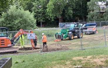
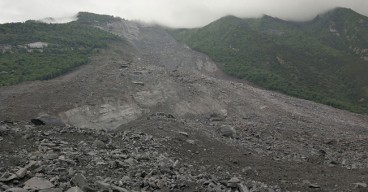
On the occasion of the Oso landslide, LiDAR technology comes forward, as an efficient means of revealing landslide risk. Signs of past landslides were obvious with bare eyes in the Snohomish County, however, a high-end technology would be necessary to evaluate the true magnitude of the slide danger. LiDAR maps generated after the landslide reveal a series of scars and debris deposited along the valley as a result of even larger events occurring in the past. LiDAR technology has been used by USGS for about a decade in the Northwest of the U.S., having mapped about a quarter of the state of Seattle, according to Craig Weaver, chief of the Seattle branch of the U.S. Geological Survey (USGS).
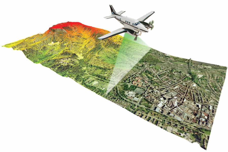
The relatively new LiDAR technology (LIght Detection And Ranging) can produce accurate topographic maps, penetrating through an area's vegetation and provide a detailed picture of the bare landscape, hence revealing a wide range of geological hazards, from earthquake faults to past landslides and flood zones. To generate a map, an airplane equipped with special lasers, flies over the mapping area, in a grid, sending over 150,000 light pulses per second to the ground. Depending on the travel time of each pulse, a computer program discards the signals which hit on trees and buildings and produces a representation of the bare landscape within a few inches accuracy.
The indisputable LiDAR importance is stressed out by University of Washington geologist David Montgomery in that "Lidar is like a new pair of glasses. If you can see more, if you have better data, you can better assess the true risks". However, it is equally important to evaluate the acquired data and communicate solid and usable information out to the public. Otherwise, "it's just nice data".
Sources: Seattletimes, NOAA
Want to read more like this story?

Washington employs LiDAR technology against landslide risk
Jan, 25, 2017 | NewsWashington's Department of Natural Resources (DNR) is making use of the best technology available to...

Damage Assessment by Laser Could Focus Post-Earthquake Response
Feb, 08, 2018 | NewsAirborne lidar surveys taken before and after a powerful 2016 earthquake in Japan revealed the poten...
Landslides
Oct, 31, 2019 | Education

About less deadly landslides!
Mar, 24, 2015 | NewsCould the Oso landslide have been avoided? Are there more landslide prone areas across the country a...
Video: NASA generated landslide map reveals most landslide prone areas!
Apr, 22, 2015 | NewsRain-induced landslides have hit a death toll of nearly 20,000 since 2007. For an overview of the la...
Arizona Geological Survey: New landslide inventory project about to begin
Apr, 09, 2015 | NewsAs a result of the continuing landslides and their detrimental effects on property and infrastructur...

How possible is a next Oso landslide event?
Feb, 27, 2015 | NewsSince the Oso landslide, the emerging question in many meetings, panel discussions and brainstorming...
Can satellites be used as an early warning system for landslides?
Aug, 04, 2017 | NewsA joint team of researchers from Newcastle University (UK), Chengdu University of Technology, Tongji...

Learning from Landslides
Jun, 10, 2015 | NewsThe Kentucky Geological Survey is compiling a landslide inventory database to document the distribut...
On This Day

Related Video

Trending

Unstable Ground: Lessons from the I-80 New Jersey Sinkhole Saga

Seequent announced extended gINT support until Dec 31, 2028

New Release: GeoStudio 2025.2


Artificial Ground Freezing: Applications, Techniques, and Key Considerations
Deadly mining landslide in Central African Republic raises safety concerns