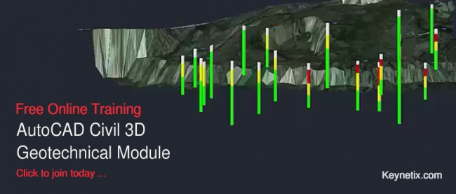
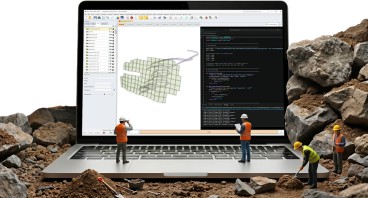
 Autodesk’s Geotechnical Module for AutoCAD Civil 3D 2017 makes it even easier to integrate and visualise geotechnical data within AutoCAD and enables improved collaboration between project teams working with BIM.
The module, developed for Autodesk by AEC Geotechnical Industry Partner Keynetix, has been completely updated for the 2017 version of AutoCAD Civil 3D. Free to download to existing users, it features a number of enhancements to improve usability.
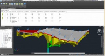
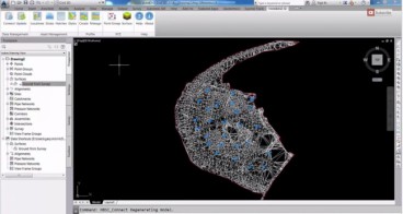
“The module allows data to be viewed more rapidly, creating geotechnical sections in seconds, with standard Autodesk Civil 3D commands used to edit and manipulate geological surfaces,” explained Keynetix Technical Director Gary Morin. “It will also link to Keynetix geotechnical data management software HoleBASE SI, enabling teams to work on, and share, geotechnical data and drawings."
“The update has a number of productivity improvements, for example, itnow allows borehole locations to be selected for manipulation using the drawing filter; strata are now colour coded, so they can be identified more easily, and users only have to check one box to create the top and bottom strata surfaces.”
Production drawings were now also easier to manage, Morin said. “Annotative text to borehole plans and log strips has been mapped to AutoCAD styles and is automatically adjusted to match the drawing scales.”
Autodesk Geotechnical Module Training
Keynetix is offering free online trainingto support the launch of the updated Autodesk Geotechnical Module, covering the essentials of the software through short videos, demo datasets, webinars and technical papers.
“The course is an excellent wayfor users to learn how to get the most out of the updated module,”Morin said. “It is presented in ‘bite-size chunks’ that can be viewed over a few weeks. We can also tailor training for more advanced users.”
The online course can be accessed for free by registering at http://geotechnicalmoduletraining.keynetix.com/

Source: http://www.keynetix.com/
Want to read more like this story?

Keynetix develops Geotechnical Module for AutoCAD Civil 3D 2015
Aug, 07, 2014 | NewsKeynetix has recently developed a new Geotechnical module, which is incorporated into AutoCAD Civil...

Learn more about the new AutoCAD Civil 3D Geotechnical Module with Keynetix
Jun, 21, 2017 | NewsKeynetix is offering a free webinar explaining the new features and capabilities of the Geotechnical...
Keynetix: New Release for Autodesk Geotechnical Module !
Jun, 25, 2015 | NewsKeynetix are delighted to announce that Autodesk have released the latest version of the Autodesk Ge...

Mastering HoleBASE SI Extension for AutoCAD Civil 3D
Apr, 22, 2019 | EventWhen: June 18, 2015 This one-day hands-on course for up to 6 delegates includes detailed trai...
Other Geotechnical
Jun, 04, 2019 | Education
Watch Keynetix's video and learn how to display Boring Data in AutoCAD Civil 3D!
Mar, 04, 2015 | NewsIn this video you will learn the best practice for importing and displaying borehole data into the G...

New Youtube video from Keynetix: Modelling Geology fault in AutoCAD Civil 3D
Jun, 26, 2014 | NewsFollowing the success of the first YouTube video on AutoCAD Civil 3D, Keynetix is pleased to present...

Keynetix: Watch this fantastic Visualization on presenting 3D borehole models!
Mar, 27, 2015 | NewsIn this video you will learn how to transform your Geotechnical Data using a 3D Borehole Model...

Civil Beta Partners Wanted; Inspirational Visualisation
Mar, 04, 2014 | NewsIt is often said a picture paints a 1,000 words and with today's technology, visualisation is being...
Form
Looking for more information? Fill in the form and we will contact Bentley for you. Alternatively, you can visit Bentley's website and speak with a Bentley Geotechnical Expert.
On This Day
Related Video

Trending

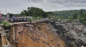
Mine waste dam failure in Myanmar caught on video

What controls the height of the world's mountains?
Scripting Comes to RS3: Automate, Customize, and Accelerate Your 3D Modelling