TatukGIS Developer Kernel (GIS SDK)

Professional grade, general-purpose GIS SDK with product editions complied natively for the Delphi, .NET, ASP.NET, ActiveX, Java, and Python development platforms. The SDK supports most leading programming languages to develop custom GIS applications for Windows, macOS, Linux, iOS, Android, and the web.
Download DocumentationThe TatukGIS Developer Kernel (DK) is a professional grade, general-purpose GIS library used in a wide range of industries to develop custom GIS applications or add geospatial functionality to existing products. A DK product edition is compiled natively for each of several development platforms, e.g., Delphi/C++Builder, .NET, ASP.NET, ActiveX, Java, and Python, offering tools compatible with most leading programming languages to develop GIS solutions for Windows, macOS, Linux, iOS, Android, and the web.
Each DK edition is highly similar, sharing the same object-oriented API with roughly 750 classes and 20,000 documented methods and properties providing comprehensive geospatial functionality without dependence on third-party libraries. Differences between DK editions are only as required by the different technologies, resulting in highly similar application source code across platforms (see comparative code example) and relatively easy migration between platforms and operating systems.
The DK agnostically supports most geospatial industry data formats. Native support for more than 70 data formats is compiled into the DK library. Dozens more formats are supported via external drivers. Advanced spatial databases such as PostGIS, Oracle Spatial, MSSQL Spatial, etc. are supported. IFC file support enables using BIM data in GIS projects. Reading and writing each format is direct, so without involving any internal or TatukGIS specific data format.
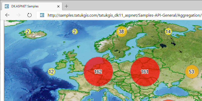
Features include powerful layer properties, legend, scale and other visual controls, 5,000+ predefined coordinate systems, on-the-fly layer reprojection, SVG symbols library, vector editing tools, spatial and SQL queries, filters, thematic mapping, data classification methods, raster algebra engine, layer statistics, binning and shape reduction, viewshed and AGL visibility analysis, vector-to-grid interpolation algorithms, point cloud-to-grid conversion, grid analysis, slope analysis, hydrology toolset, operation pipelining, topological operations, address geocoding/reverse geocoding, GPS tracking, routing, 3D visualization, and compatibility with industry standards.
The DK is licensed per developer, with no deployment royalties or run-time fees. Licensing is by product edition for a particular development platform or as an Enterprise package aggregating support for all available platforms and advanced spatial databases.
| Category | Other Geotechnical , Visualization , Numerical & Constitutive Modeling , Oil & Gas , Geoenvironmental Engineering , Geomatics , Aerial , Engineering Geology , LiDAR , Site Response Analysis , Groundwater & Seepage , Transportation Geotechnics |
| Licence Type | Commercial |
| Operating Systems | Windows XP, Windows NT, Windows 95/98, Windows 7, Windows 2000, Windows Vista, iOS, Android, Linux, Windows 10, Windows 8, Windows 11, Linux |
| Current Version | 105.0 |
| Release Date | 2025-09-05 00:00:00 |
| Developer | TatukGIS |
| Developer Website | https://www.tatukgis.com |
| Developer Email | [email protected] |
| Changelog | https://docs.tatukgis.com/DK11/readme:changelog |

Recommended Software


Oasis montaj

Res2DInv and Res3DInv

GEO5 Data Collector - free mobile app