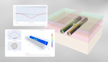
Orica Digital Solutions Geosolutions' Unlocking operational insights for subsurface injection and production with InSAR data begins on Jul 21st 2026
Orica Digital Solutions Geosolutions' Unlocking operational insights for subsurface injection and production with InSAR data begins on Jul 21st 2026
Create a free account and view content that fits your specific interests in geotechnical engineering Learn More
GGU-SS-FLOW2D
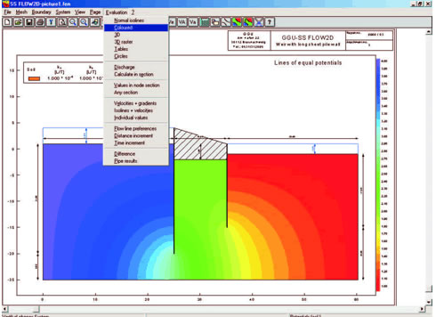
Modelling of steady-state groundwater flow in
horizontal-plane,
vertical-plane,
axis-symmetrical,
two-dimensional groundwater systems using the finite-element method.
Capabilities:
Powerful mesh generator with mesh refinement and mesh optimisation
Import of ASCII-Data
FEM mesh coordinates can be imported from a table via the Windows clipboard
Consideration of leaky aquifer, seepage lines and unsaturated zones
Definition of layer boundaries using fixed values or an interpolation mesh (ASCII data import from the GGU-GEO-GRAPH program)
Graphically oriented data input and editor for fixed boundary conditions such as potentials and point, linear or area sources
Adopts standard values for kr = f(u) and visualisation as contours
Easy-to-use evaluation routines
Dynamic damping
Colour supported presentation of results such as normal, coloured or 3-dimensional contour lines, tables or circle diagrams
Evaluation and presentation of potentials, velocities vx, vy and discharge in userdefined sections
Evaluation and coloured presentation of seepage velocities and gradients
Evaluation and presentation of groundwater thickness, groundwater-surface distance, confined areas and "dry" areas
Evaluation and presentation of flow lines with distance and time increment
Calculates a differential contour diagram from two existing groundwater models and visualises them as normal, colour-filled or 3D contours
Automatic transfer of steady-state data to the GGU-TRANSIENT and GGU-CONTAM-FE/-RW programs for transient analysis
Interface for the program GGU-SS-FLOW3D (3-dimensional groundwater systems)
Autosave function
User-defined design of output sheet
Print or copy screen sections, e.g. for transfer to a word processor
Integrated Mini-CAD system for additional annotation of graphics
| Category | Groundwater & Seepage |
| Licence Type | Commercial |
| Operating Systems | Windows XP, Windows NT, Windows Server 2008, Windows 8, Windows 7, Windows Vista |
| Developer | GGU-Software |
| Developer Website | http://www.ggu-software.com |
| Developer Email | [email protected] |
This feature is only available for software listings at the Advanced or Lead Sponsorship Level. Each software provider can upgrade the sponsorship level of their software listing by visiting the sponsorship levels page.
Recommended Software

Aug, 16, 2019
GEO5 FEM - Water Flow


Dec, 29, 2022
Leapfrog Works

Jan, 19, 2023