Drone-based footage of Damage following the November 17th 2015 Lefkada Earthquake

Within less than 48 hrs following the Mw 6.4 earthquake that occurred near Lefkada island in Greece, on November 17th 2015, engineers from Geoengineer.org, the University of Michigan (USA) and the University of Patras (Greece) mobilized to quickly perform condition assessment at select sites that are of potential scientific interest. The team deployed an Unmanned Aerial Autonomous Vehicle (UAAV) that was able to collect footage of affected areas. The UAAV successfully by-passed roads that were closed by landslides and other damaged infrastructure that impacted accessibility.
The team launched the unprocessed video below immediately following UAAV deployment to make available data and footage that may prove valuable to first responders, engineers, rescue operators and damage assessors. The video includes footage from the port of Vasiliki (@0:00), the town of Vasiliki (@7:00), the damaged pier in Vasiliki port (@12:00), the Ponti village rock fall that killed one person (@16:00) and where the impressively long route of the rock fall was documented, and the extensive landsliding in Egremni beach (@24:00).
The video is not corrected for camera distortion and is not annotated at this stage, but aimed to distribute useful data in the most expedited manner and allow the scientific community and engineers to get a better view of what has happened.
This demonstration effort is part of the broader research objectives of a National Science Foundation titled “Post-Earthquake Aerial Reconnaissance of Geotechnical Engineering Systems.” More information can be found here: http://www.nsf.gov/awardsearch/showAward?AWD_ID=1362975 . The lead Principal Investigator of the grant is Prof. Dimitrios Zekkos from the University of Michigan, and the leading collaborator in this specific reconnaissance effort from the University of Patras is Prof. George Athanasopoulos.
View the video here: https://www.youtube.com/watch?v=CR4WYNc_vEQ
Want to read more like this story?

The Use of Small Unmanned Aerial Vehicles for Post-Disaster Geotechnical Reconnaissance Webinar Video Share
Dec, 23, 2016 | NewsThe Use of Small Unmanned Aerial Vehicles for Post-Disaster Geotechnical Reconnaissance Webinar outl...

Second Major Earthquake hits Cephalonia island in Greece; causes significant damage; information hub established on GeoWorld; updates to follow
Feb, 03, 2014 | NewsA new Mw 5.7 earthquake hit Cephalonia at 5:08 am on February 3rd 2014, less than 10 days after the...

Introducing New Technologies for Geotechnical Infrastructure Sensing & Monitoring
Dec, 16, 2020 | EventThe objective of this course is to introduce a wide range of new technologies for geo-infrastructur...

Introducing New Technologies for Geotechnical Infrastructure Sensing & Monitoring
Apr, 05, 2021 | EventThe objective of this course is to introduce a wide range of new technologies for geo-infrastructur...

New Zealand Kaikoura 7.8M Earthquake Reconnaissance Efforts Take Advantage of Drone and 3D Mapping Technology
Jan, 13, 2017 | NewsGeoengineer.org join forces with University of Michigan, GEER reconnaissance team and GNS science ge...
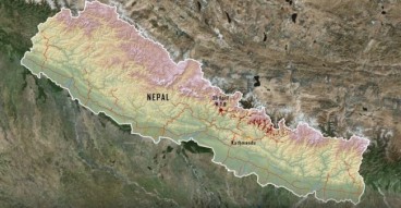
Researchers use Drones to Map Landslides in Nepal.
Mar, 21, 2016 | NewsThe landslides were caused by the Gorkha 2015 earthquake. More than 20,000 landslides took place...

Videos: landslides triggered during Nepal quake caught live, drone images of destruction and CCTV footage.
Apr, 29, 2015 | NewsTwo new videos reveal the devastation caused by the magnitude 7.8 Nepal earthquake, that severely af...

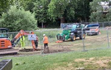
New Video Highlights Research on the In-Situ Assessment of the Seismic Properties of Municipal Solid Waste
Sep, 23, 2013 | NewsA new video released last Friday highlights new research funded by the National Science Foundation t...

Greece struck by powerful Mediterranean hurricane: Floods and destruction across the country
Sep, 17, 2020 | News3 people have been confirmed dead and 2 more are missing after a powerful hurricane struck Greece....
On This Day
July 20th 1940
READ MORE
Related Video

Trending

Quick Clay Failure on Norway’s E6 at Levanger

Keller North America announces recent leadership changes


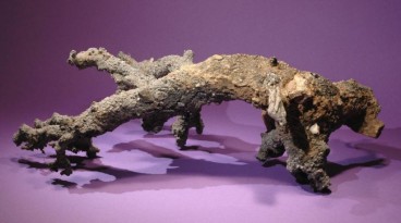
Fulgurite: A rare phenomenon
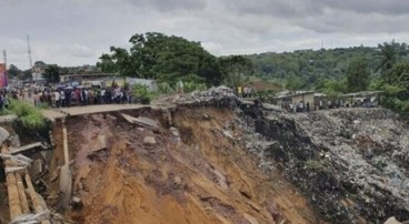
Deadly mining landslide in Central African Republic raises safety concerns