New Zealand Kaikoura 7.8M Earthquake Reconnaissance Efforts Take Advantage of Drone and 3D Mapping Technology

Geoengineer.org join forces with University of Michigan, GEER reconnaissance team and GNS science geologists and engineers to provide UAV expertise in 3D mapping of landslides and ground-surface fault ruptures.
The M7.8 Kaikoura Earthquake of 14 November, 2016 (NZDT) was a complex and remarkable event for the large number of ground-surface fault ruptures and landslides triggered throughout a large area of New Zealand's South Island. The catastrophic event left New Zealand not only with 2 human casualties, home collapses, roads and railways destroyed and tourist resorts evaquated but also with an altered topography. The earth 'unzipped' within an approximate southwest to northeast extent of 180 km length of surface rupture along at least 12 faults featuring up to 10-12 m dextral and 2m vertical displacement, 80 km uplifted coastline up to 5m height, and tens of thousands of landslides some of them monitored as potential threats for catastrophic flooding due to river damming.
A significant leap in earthquake disaster reconnaissance and study was made possible thanks to the immediate coordinated efforts of scientists and technicians from around the world. UHD camera enabled drones and 3D mapping processing enabled the team to capture the devastated earth's surface in great detail rarely accomplished in the past few years. High resolution Digital Surface Models and orthophotos of the affected areas will serve geologists and earthquake engineers as 2D/3D basemaps for answering questions related to topography interaction with the fault rupture, as earthquake geologist Russ Van Dissen from GNS science suggests in a NZ Geographic article, or as comparison spatial features for larger scale projects such as University's of Michigan NSF funded study led by Prof. Marin Clark and Prof. Dimitrios Zekkos of generating pre and post-earthquake high-resolution digital topographic maps from 30cm satellite stereoscopic pairs for the whole affected area.
One thing is for sure, with all this highly accurate and detailed spatial data gradually becoming available, the Kaikoura Earthquake will be likely one of the most documented and measured natural event than any other in our recent history.
Enjoy watching two photo and drone footage compilations featuring our reconnaissance efforts!
Want to read more like this story?
Earthquake Reconnaissance
Apr, 09, 2020 | Education

Massive earthquake struck off the coast of New Zealand
Jun, 18, 2020 | NewsA M 7.4 earthquake struck off the coast of New Zealand raising concerns about a potential tsunami....

Earthquakes triggered by landslides
Jul, 02, 2020 | NewsIt is widely known that earthquakes can trigger disastrous landslides but, what about the opposite?...
A new underlying mechanism in deadly 7.1R quake in Taiwan in 1906 has been uncovered
Jun, 11, 2018 | NewsThe earthquake was one of the deadliest to ever strike the country The earthquake was one of the...
New AI method to detect microearthquakes
Dec, 07, 2020 | NewsScientists from Stanford University and Georgia Institute of Technology in the United States, intro...

Mexico gets hit again by deadly M7.1 earthquake (video)
Sep, 22, 2017 | NewsThe earthquake struck central Mexico on Tuesday, September 19, killing at least 250 people. The 7...

Kaikoura Earthquake responsible for “slow motion” quakes in New Zealand
Oct, 06, 2017 | NewsThe 7.8 magnitude quake that hit New Zealand's South Island in November 2016, is responsible for a s...

Useful preliminary findings from the earthquake sequence in central Italy unveiled by an Italy-US GEER team's engineering reconnaissance
Sep, 19, 2016 | NewsUseful preliminary findings from the earthquake sequence in central Italy unveiled by an Italy-US GE...

Study suggests that smaller earthquakes generate most strong ground motions
Jan, 04, 2021 | NewsAccording to a new study, smaller earthquakes have caused the strongest shaking incidents in the vi...
On This Day

Related Video

Trending

Lake Chippewa’s floating island that has to be boat-pushed every year

How to Model Piles in PLAXIS

3 Types of Retaining Walls and Revetments


How Do Dams Trigger Earthquakes?
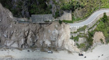
Nepal’s Himalayan settlements face escalating flood and landslide threats