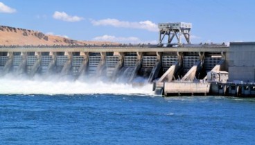
The company is using the drones for topographical measurements regarding the construction of 100 dams in the African country.
The construction project is financed by the World Bank and the African Development Bank and will run for three years. It includes the construction of up to 100 dams in 10 provinces of Zambia. Each dam will be up to 15 m high and will store water to be used by the local rural communities for irrigation puproses and water supply during the drought season.
With the aid of drones, Cowi is mapping the locations of the proposed dams, stating that this approach is twice as fast and more accurate compared to traditional methods.
Source: The Construction Index
Want to read more like this story?

Dam Engineering
Apr, 10, 2020 | EducationA dam is an infrastructure system that consists of several structures with the intent to collect,...

Aging dam infrastructure: A severe future threat
Jan, 22, 2021 | NewsAccording to a new report, issued by the United Nations University, aging water storage facilities...
May 31st is National Dam Safety Awareness Day in America
May, 31, 2016 | NewsOn the May 31st we commemorate the significant role dams play in American life. From providing nearl...

Satellite data indicate over 2,500 U.S. dams are in poor condition
Dec, 21, 2025 | NewsDams across the United States are aging and underfunded, with geoscientists reporting that over 2,5...
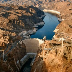
History of the Hoover Dam
Jun, 30, 2020 | NewsIntroduction Hoover Dam is the tallest arch dam constructed in the United States and forms one of...

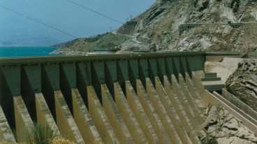
The Dam of Stratos
May, 10, 2019 | EducationConstruction: Started in 1981 and ended in 1988. Length of the crest: 1900m Height: Small height...
Concrete / Rollercrete Dams
May, 22, 2019 | EducationGravity Dams A Gravity Dam is made of soil, rock, concrete or masonry. For soil and rock dams, s...

Savings in removing over repairing dams
Jul, 09, 2018 | NewsDam removal has become a mainstream option for dam safety management restoring river, coastal ecosys...

Dam Safety Association Presents Annual Awards
Nov, 27, 2006 | NewsAt each annual conference, the Association of State Dam Safety Officials recognizes individuals who...
On This Day
July 20th 1837
READ MORE
Related Video

Trending

Brownfield success: Engineering excellence starts below ground


Scripting Comes to RS3: Automate, Customize, and Accelerate Your 3D Modelling

2D and 3D Analysis of Retaining Systems

Mine waste dam failure in Myanmar caught on video

Asbestos remains a deadly infrastructure risk across the UK

Major earthquake in southern Philippines causes deaths and widespread damage