Bentley Adds Geotechnical and Geoenvironmental Capabilities Through Acquisition of gINT Software Sponsored
Bentley Systems, Incorporated, the leading company dedicated to providing comprehensive software solutions for the infrastructure that sustains our world, today announced, at this invitation-only gathering of top users from around the globe, that it has acquired gINT Software. Headquartered in Santa Rosa, Calif., gINT Software has been a leader in geotechnical and geoenvironmental products since its founding in 1986. The company’s newest product, gINT Enterprise, maximizes the value of centrally managed subsurface data through multi-project reporting and dramatically extended querying power. Offering a powerful and efficient solution for transportation operations, engineering consultancies, plants, campuses, and state and federal agencies with vast quantities of geotechnical data, gINT Enterprise facilitates the valuable reuse of subsurface mapping information to better serve civil, structural, geotechnical, and environmental information processes for owner-operators.
“This extension of our portfolio into the geotechnical and geoenvironmental arena came about through a shared vision between Bentley and gINT. We both recognize and embrace the tremendous opportunities for value creation that can be realized through enhanced interoperability and increased data reuse within information modeling, now to include the subsurface mapping that is a vital aspect for every infrastructure project,” said CEO Greg Bentley. “‘Intra-operating’ software from Bentley will introduce information modeling that extends to conditions below the ground. And Bentley’s new i-model ‘currency of exchange,’ for change-managed deliverables, will facilitate the full integration of geotechnical specialists’ project contributions. Infrastructure project quality will benefit from finally incorporating geotechnical workflows within information modeling.
“On behalf of all Bentley colleagues, I welcome gINT users to the Bentley user community and gINT colleagues to the Bentley team. We look forward to working with both to “mainstream” further innovations in geotechnical and geoenvironmental applications.”
“We are excited to be joining Bentley, especially given the synergies between Bentley’s broad portfolio of engineering tools for sustaining infrastructure and gINT’s subsurface expertise,” said Salvatore Caronna, president and CEO of gINT Software, who is being named Bentley director of product management, Geotechnical and Geoenvironmental Products.
Caronna continued, “Thousands of infrastructure professionals already have both Bentley and gINT products as part of their toolsets, and they have wished they could take simultaneous advantage of their respective innovative capabilities. Integrating these products opens the door to immediate benefits in transportation, mapping, and engineering projects of all types. One case in point: by integrating gINT Enterprise, other gINT products, and Bentley’s AEC-leading geospatial applications and servers, we will be creating unprecedented solutions for geotechnical investigations and environmental monitoring and remediation.”
With the phased rollout of gINT Enterprise, infrastructure professionals can expect to:
Report on and query subsurface data from an unlimited number of projects,
Standardize how an organization’s data is entered, imported, stored, and reported,
Share data with related software programs including CAD, GIS, contouring, and modeling applications, and more,
Visualize gINT data using the software’s extension for ArcGIS.
Users of gINT software number in the thousands and range from one-person firms to the world’s largest and most prestigious multinational engineering organizations. Among them are 32 departments of transportation, the U.S. Federal Highway Administration, 34 districts of the U.S. Army Corps of Engineers, the U.S.D.A., the U.S. Bureau of Reclamation, the California Department of Water Resources, municipalities and regional governmental agencies around the world, major universities, and leading engineering organizations such as URS Corporation, Terracon, Bechtel, SKM, Arup, CH2M HILL, and many more.
Read additional information about the gINT product line.
Want to read more like this story?

Learn more about Bentley's geotechnical software!
Feb, 11, 2013 | NewsIf you want to know more about Bentley Systems' geotechnical software products, take a look at thei...

Bentley adds new functionality to its popular gINT software
May, 20, 2014 | NewsWith subsurface investigations and analysis being at the core of every project, Bentley’s software...
gINT Software Announces New Enterprise SQL Server Edition
May, 08, 2009 | NewsgINT Software announces the release of “gINT Enterprise,” a new SQL Server version of gINT. gINT Ent...
GEO5 (Fine Software) Distribution Deal Signed by gINT Software
Oct, 02, 2008 | NewsgINT Software, Inc., developer of gINT data management and reporting software for geotechnical and g...

Subsurface Asset Management: What Lies Beneath? New webinar series by Bentley!
Sep, 12, 2014 | NewsDo you want to learn how to improve the management and reporting of your subsurface information? Wit...
A new upgrade to gINT geotechnical and geoenvironmental software lets users publish boreholes to Google Earth
Sep, 18, 2008 | NewsGoogle Earth Integration Offered for gINT Borehole Data: Related Images, Calculations, Automated Di...

gINT V8i: Free Trial for 30 days!
Sep, 16, 2013 | NewsBentley’s gINT software provides centralized data management and reporting for subsurface projects...
gINT Software Webinar Series to Focus on Enterprise Solutions and GIS Applications - Topics to include how to improve subsurface data in GIS interface
Sep, 14, 2009 | NewsgINT Software will be hosting a series of webinars in September and in October covering a wide varie...

SIG Workshop: Geotechnical Information – OpenGround, Preparing to Take Your Data to the Cloud
Mar, 06, 2020 | EventThis Geotechnical Information Special Interest Group virtual workshop focuses on getting started wi...
Form
Looking for more information? Fill in the form and we will contact Bentley for you. Alternatively, you can visit Bentley's website and speak with a Bentley Geotechnical Expert.
On This Day
July 20th 1940
READ MORE
Related Video

Trending
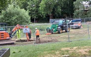
Brownfield success: Engineering excellence starts below ground

Scripting Comes to RS3: Automate, Customize, and Accelerate Your 3D Modelling

2D and 3D Analysis of Retaining Systems

Mine waste dam failure in Myanmar caught on video

Deadly mining landslide in Central African Republic raises safety concerns