Most levees are still inspected on foot, on paper, and only once a year. That leaves dangerous blind spots — and by the time a problem is visible, it's often too late to act cheaply or safely. EZ Digital Twins built the Levee Digital Twin platform to close those gaps. It unifies every inspection, sensor reading, and survey into a single living 3D model of your levee system — accessible from your browser, fully georeferenced, and updated over time. What you can do with it: - Explore high-resolution 3D reconstructions of your levees and assets - Compare LiDAR, thermal, and multispectral data side by side - Track subsurface conditions using electromagnetic resistivity and borehole data - Monitor live sensor readings and burrow activity as they change - Keep a complete, auditable recor Show more
Related Videos


Read more about this
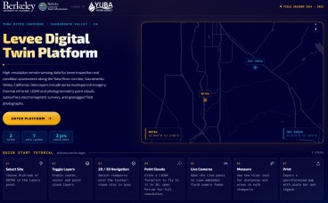
Levee Digital Twin Platform Launches for California's Yuba River Corridor
Jun, 11, 2026 | NewsResearchers at UC Berkeley, funded by Yuba Water, have unveiled the Levee Digital Twin Platform — a...