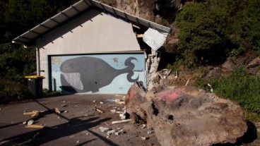
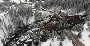
Buildings prone to cliff collapse are being demolished in Port Hills, Christchurch

Many rockfalls and landslides were triggered by a severe earthquake in Christchurch in 2011, resulting in many damaged homes. Last Sunday the Canterbury Earthquake Recovery Authority (CERA) released a statement, announcing the beginning of the demolition of red-zoned, earthquake-affected buildings, on Monday.
The authority states that it will be a demanding but well-planned task, reassuring the public about the workers' safety. Demolishing buildings on the top of a slope will be very dangerous for the workers, so freight containers will be on site to act as safe zones. Chief executive Roger Sutton said that large water-blasters and controlled explosives will be used. Aerial drones will capture images of the sites. Escape routes will also be identified and spotters will observe the demolition work in order to detect any sign of rockfall. The Government has proposed a buyout offer to the owners of the red-zoned properties and they now have to decide whether to accept it.
See more images from a CERA drone, showing properties in the Cliffton Hill Suburb here.
Sources: blogs.agu.org, The Press
Nearby News
Want to read more like this story?

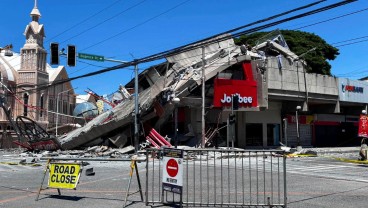
Venezuela earthquakes leave hundreds dead as rescue teams search collapsed buildings
Jun, 25, 2026 | NewsVenezuela has declared a state of emergency after two powerful earthquakes struck the country, causi...
Christchurch City Council Warns Port Hills Residents Against Returning to Their Homes
Jul, 08, 2016 | NewsEarlier this week, Christchurch laws restricting residents of Port Hills from their homes in a rock...

UB earthquake engineers: building collapses in the Turkey-Syria earthquake were not unexpected
Feb, 06, 2023 | NewsA scene, shown in various videos, was taken following the 7.8-magnitude earthquake and subsequent t...

More than 20000 fatalities after Turkey-Syria earthquake
Feb, 09, 2023 | NewsAt least 20,000 people have now died as a result of the earthquakes that struck southwest Turkey an...
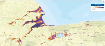
Landslide and liquefaction mapping becomes critical after major quakes
Jun, 29, 2026 | NewsRecent major earthquakes in Venezuela and the southern Philippines have highlighted an important les...

Earthquakes in Italy Leave 250 Dead; Rescue Efforts Continue
Aug, 24, 2016 | NewsEarly Wednesday morning, a magnitude 6.2 earthquake struck central Italy. Some of the most heavily a...

Thousands of Los Angeles buildings may need to be seismically retrofitted after PEER report
Jun, 02, 2014 | NewsA decade after the identification of potentially vulnerable concrete school buildings across th...
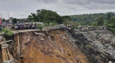
Major earthquake in southern Philippines causes deaths and widespread damage
Jun, 08, 2026 | NewsA powerful magnitude 7.8 earthquake struck off the coast of Mindanao in the southern Philippines, ki...
Geotechnical Earthquake Engineering
Apr, 21, 2020 | Education
On This Day
July 17th 1886
READ MORE
Related Video

Trending
Active landslide threatens long-term connectivity in southern Bulgaria


PLAXIS example: Westergaard's added mass for hydrodynamic pressures

Rock Mass Classification Systems: A Global Review of Use and Dominant Approaches

How does the Leaning Tower of Pisa survive earthquakes


Levee Digital Twin Platform Launches for California's Yuba River Corridor