Liquefaction During the Loma Prieta Earthquake
Contents [show]
Introduction
Liquefaction is a serious hazard that much of the San Francisco Bay Area faces. To determine the areas at risk for liquefaction, one must look at the soil composition and saturation level. Liquefaction is most likely to occur in fully saturated sandy soils.[1] During earthquake conditions, the shaking of the ground causes the soil to behave like a very viscous liquid, and creates a large and sudden reduction in the soil’s ability to support foundations of structures.[1] Liquefied soils also pose a great risk to dams and retaining walls as they apply a high pressure against the structure, causing them to tilt and even slide.[1]
Much of the San Francisco Bay Area soil has the composition to be at very high risk for liquefaction. A majority of the soil in the Bay Area is composed of young mud deposits which will undergo much more shaking than areas composed of bedrock. An even higher hazard than the prevalent young mud is the areas made of man-made landfill.[2] When the Bay Area was settled in the mid nineteenth century, large amounts of the Bay were filled in with hydraulic fill to create more room for infrastructure and the growing population. Thus, nearly all of the Bay shoreline faces serious liquefaction risk. One such example of the liquefaction risk in the Bay Area can be seen in the San Francisco Marina District, located along the northern shoreline of the City of San Francisco, which underwent incredibly destructive liquefaction during the 1989 Loma Prieta earthquake.
Liquefaction
The liquefaction phenomenon occurs because of the conditions of a particular soil deposit. In a regular soil deposit, each individual soil particle is in contact with its neighboring soil particles. These contact forces “hold the individual particles in place and allow the shear resistance of soil to support a structure on the ground surface.”[1] When shaking of the ground occurs during an earthquake, saturated soil particles lose contact with each other and enter into a very loose configuration.[3] The loose soil wants to move into a denser packing configuration, but the water in the pores does not have enough time to be squeezed out, due to the rapid loading induced in an earthquake.[1] With this reduction of contact force in the soil, the water bears any loads that were previously borne by the soil. If the pore water pressures become high enough, the soil particles will lose all contact with each other and enter into suspension. This creates a very rapid loss of strength and stiffness, and the soil will behave like a liquid with the unit weight of the saturated soil. [1]
In a saturated sandy soil, the shear strength is given by:[1]
Thus, the entire normal effective stress on the soil is taken on by the water during intense earthquake induced shaking. When the soil liquefies to this degree, it has the ability to flow and can no longer support the load of structures on top of it. This can cause serious damage to infrastructure, as seen in San Francisco Marina District during the 1989 Loma Prieta earthquake.
Marina District Soil Composition
The reason the Marina District underwent such high levels of liquefaction during the Loma Prieta earthquake can be traced back to its soil composition. Prior to the late nineteenth century, much of the modern-day Marina District was underwater in the San Francisco Bay. Several stages of fill were placed in this area, beginning around the 1870s to create the Marina District. Much of the fill consisted of “uncompacted fine sands and silty sands.”[4] The first fill stage occurred from 1870 to 1900 using dune sand, and “consisted primarily of placement of loosely dumped fill around the perimeter of the small Marina bay and in the perimeter marshes.”[4] A seawall was also constructed during this phase to create an enclosed harbor on the shore of the district.[4]
The second phase of fill occurred after the 1906 earthquake to create the location for the 1915 World Fair. In this phase, the harbor created by the seawall in the previous phase was filled in with hydraulic fill. This hydraulic fill composted of roughly seventy percent sands and thirty percent mud, dredged from the Bay floor, about three hundred feet offshore.[5] The fill was “pumped in hydraulic suspension into the enclosed harbor and allowed to settle,” a process which often results in a “loose saturated fill which is vulnerable to potential soil liquefaction during earthquake shaking.”[4] Large amounts of water were often also pumped through the fill in attempts to remove mud, resulting in a fully saturated soil.[5]
Following the completion of the 1915 World Fair, a third phase of fill was conducted in the Marina District. Much of the infrastructure created for the fair was demolished and concrete debris and wood piles were often left in the area.[5] In addition, some areas were also “filled partly by the public dump method” before more Bay mud was dredged and pumped over top.[5]
Final small amounts of fill occurred over the next few years before the area underwent significant residential construction in 1924.[5] Thus, the Marina District has a variable soil composition, with its components differing based on location and depth. This caused varying degrees of liquefaction to occur throughout the district during the Loma Prieta earthquake.

Figure 1: Locations of artificial fills in the Marina District[5]
1989 Loma Prieta Earthquake, Marina District
The Loma Prieta earthquake occurred on Tuesday, October 17, 1989.[6] The epicenter was located on the San Andreas fault line in the Santa Cruz Mountains, over sixty miles south of the Marina District.[6] The shaking lasted roughly twenty seconds and had a Magnitude of 6.9. Thousands of aftershocks occurred over the following week.[6] It is estimated that the earthquake caused upwards of ten billion dollars in damage, and remains one of the costliest single natural disasters in United States history.[6] The earthquake caused significant liquefaction in the Marina District, which caused sand boils, lateral spreading, settlement, bearing failures, pavement damage, foundation damage, and damage to buried utilities throughout the district.[4]
The most significant evidence that liquefaction had occurred in the Marina District was from the sand boils. Throughout the entire district, the liquefied sand was under such significant pressure from the shaking that it erupted through the ground surface. The composition of these sand boils was important in understanding which composition of soil and type of hydraulic fill underwent the most significant amount of liquefaction. Most of the sand boils were “fine grained gray sand, commonly containing shells.”[6] This would indicate that the post-1906 earthquake fill, which was dredged from the Bay floor, underwent the most intense liquefaction in the area. Fewer sand boils were composed of larger brown sand and contained pieces of charred wood.[7] The larger grain size and brown color indicates that these sand boils came from the dune sand placed during the original filling of the district.
Another type of destruction attributed to liquefaction was the cracks, settlement, and lateral movement that occurred in the pavement and sidewalks. The size and shape of the cracks in the pavement indicated how the subsurface soil behaved when it liquefied. Lateral cracks in the pavement indicated shearing induced by the horizontal displacement of liquefied soil.[7] In other areas, the liquefied soils underwent significant compression, which resulted in the sidewalks being thrust up into tent-like shapes.[7] Most of the cracks occurred in the areas of hydraulic fill, and generally showed less than one hundred millimeters in settlement or lateral movement.[7] Additionally, the largest of the cracks were located along the border between the 1912 hydraulic fill zone and the older fill and beach deposit zones.[7] Thus, the higher degree of liquefaction in the hydraulic fill relative to the older fill and beach deposits lead to damaging differential settlement of the pavement. This means that the variable soil composition of the Marina District played a significant role in the liquefaction damage that occurred.
Similarly, the most damaged buildings were also located in the hydraulic fill areas. In these areas, the liquefied soil lost so much strength and stiffness that it was unable to support the loads of the buildings on top of it. In areas where the liquefaction was less intense, the first floors often tilted, but did not result in the collapse of the entire building.[7] In areas where the liquefaction was more intense, entire buildings collapsed or toppled over.[7] Every single building in the Marina District that collapsed or was damaged enough to require demolition was located on hydraulic fill.[7] Further evidence that liquefaction was the cause of most of this damage comes from the sand boils and intrusions found in the garages and surrounding sidewalks of damaged buildings.[7]

Figure 2: Damage to homes due to liquefaction during Loma Prieta, 1989[8]
Post-Earthquake Liquefaction Analysis
Following the Loma Prieta earthquake, extensive testing was done on the soils, especially in the liquefaction areas. Standard penetration tests (SPT) of the Marina District showed a blow count range of N1 roughly equal to seven to twelve blows per foot in the fill zones.[4] Natural alluvial deposits in surrounding regions showed an N1 range of fifteen to twenty-five and higher blows per foot.[4] These natural deposits with higher blow counts did not liquefy during the earthquake. The relatively low blow count in the liquefaction zones indicates that decreasing density and stiffness in soils correlates with a higher liquefaction potential.
Additionally, the liquefaction resistance of the fill and natural deposits was determined. The simplified procedure used correlates the SPT blow counts and the cyclic stress ratio (CSR) [7]. The CSR indicates the liquefaction resistance of a soil as a function of the soil’s density and depth, water table elevation, and earthquake acceleration.

Where:
a = maximum earthquake acceleration
g = acceleration due to gravity
total stress = total weight of overlying soil and water
effective stress = initial vertical effective stress
rd = stress reduction factor
The CSR for the fill areas was calculated using a minimum acceleration of 0.16g and a maximum acceleration of 0.32g, which had been measured at different locations throughout the area during the earthquake. The density of the fill was taken to be 120 pcfand the density of the natural soil was taken to be 130 pcf. As shown in the figure below, most of the fill liquefied at the minimum acceleration, and all of the fill liquefied at the maximum acceleration. Most of the natural soil did not liquefy at the minimum acceleration, and small amounts liquefied at the maximum acceleration.

Figure 3: Penetration resistance, correlation between CSR and SPT blow count[7]
The results from soil testing in the Marina District revealed a “significantly higher level of liquefaction vulnerability” than previously been assumed in the Bay Area.[4] Since a large majority of the fill samples liquefied at the minimum acceleration induced by the earthquake, it can be concluded that future earthquakes, even at much smaller magnitudes than Loma Prieta, will see some degree of liquefaction in the Marina District.
Current Liquefaction Risks
Even today, over thirty years after Loma Prieta, liquefaction remains a serious hazard for large amounts of Bay Area infrastructure. In the City of San Francisco alone, over one hundred buildings taller than 240 feet are in areas with a very high liquefaction potential.[9] Current building codes require that structures must “be engineered to have a 90 percent chance of avoiding total collapse.”[9] However, the code does not stipulate that the buildings that remain standing must be fit for use. Buildings that do not collapse would still be allowed to undergo significant damage to pipes, interior walls, and foundations, which are the types of damage that are common during liquefaction. Dr. Keith Porter, a seismic engineer at the University of Colorado, has also calculated that at least one quarter of Bay Area buildings might be unsafe for use after a magnitude 7 earthquake due to liquefaction.[9]

Figure 4: Liquefaction risks in San Francisco[9]
Additionally, surveys conducted after the 1989 earthquake revealed the most dangerous impacts of liquefaction during future earthquakes. As indicated in the map below, liquefaction is not a risk only in the City of San Francisco. Shoreline areas along the entire perimeter of the San Francisco Bay have varying degrees of hydraulic fill, and, as such, are also susceptible to liquefaction. This widespread liquefaction potential poses serious risk to the safety of citizens and emergency services, even if they are not located near the epicenter. Based on the widespread areas of liquefaction potential, the entire Bay Area will likely also face significant damage to essential infrastructure in the event of a future large-scale earthquake. First, Oakland International Airport, Alameda Naval Air Station, and San Francisco International Airport will likely lose service due to their locations in liquefaction zones.[4] This will be especially dangerous because these locations will be needed to allow emergency personal to arrive. The harbor facilities in both San Francisco and Oakland would likely be damaged by liquefaction during a future earthquake, when they would also be vital for emergency services.[4] Therefore, future Bay Area earthquakes pose significant risks to lives and infrastructure beyond the damage caused solely by the shaking.

Figure 5: Bay Area liquefaction zones shown in green[10]
Mitigation Efforts
To combat the dangerous loopholes in the building code, efforts have been made to tighten restrictions. One such effort was a bill introduced by Adrin Nazarian to the California State Legislature.[9] This bill would require new buildings to be strong enough for functional recovery after an earthquake.[9] This means it would not be enough for a building to simply remain standing in order to meet the code. Additionally, Dr. Porter believes future additions to building code should focus on the city as a whole, rather than just individual buildings.[9] Disasters like the Loma Prieta earthquake have shown that liquefaction can cause damage to pavement, sidewalks, and underground utilities as well. Protecting these other forms of civil infrastructure is important to ensure the survival of a city like San Francisco after a large earthquake.
Additional research and development has been ongoing towards engineering ways to mitigate the potential for liquefaction induced damage in earthquake conditions. These solutions can be divided into three categories: soil improvement, structural improvement, and the total avoidance of soils susceptible to liquefaction. Soil improvement techniques such as vibroflotation and dynamic compaction work by compacting loose soils.[1] These methods use vibration and load application to induce local liquefaction, which densifies the soil and removes excess pore pressures.[1] Denser soils are less likely to liquefy during earthquakes because they are stronger and stiffer than loosely compacted soils. Other soil improvement techniques involve placing piles, columns, and/or grouting agents into the soil.[1] These methods also help to densify and stiffen the surrounding soils, reducing their liquefaction potential. In areas where soil improvement is not feasible and construction in liquefaction zones is necessary, structural improvement techniques are used. Designing structures to be liquefaction resistant involves both shallow and deep foundation improvements. In shallow foundations, all components should be tied together.[1] This will help protect the foundation against differential settlements in a liquefaction event. This in turn decreases the shear forces experienced by the structure on top of the foundation, and will hopefully keep the structure standing.[1] In deep foundations, large, reinforced piles that reach beneath the liquefiable soil layers are important.[1] The piles must be deep enough to be anchored in stronger soils that will not liquefy, and must also be ductile enough to allow some movement during liquefaction, while resisting overturning.[1]
The best strategy to avoid damage to infrastructure during a liquefaction event is to avoid construction in areas where the soil has the potential to liquefy. This can be done through extensive site testing to determine if the soil composition meets the liquefaction criteria.
Conclusions
The San Francisco Bay Area is home to millions of people and the headquarters of numerous corporations and industries. It is a hub of innovation and technology that is invaluable to both the United States and the global economies. The extensive damage that occurred in the Marina District in the City of San Francisco is only a small portion of the total liquefaction damage that occurred throughout the entire Bay Area during the Loma Prieta earthquake.
While a number of engineering strategies already exist to mitigate the potential liquefaction damage to infrastructure, most of them are not feasible in the Bay Area. The Bay Area is already densely packed with structures, many of which reside on soils susceptible to liquefaction. Thus, it is too late to implement most soil improvement and structural improvement mitigation techniques. Many of these structures were also built decades ago, and thus would not be helped by the legislative efforts to update the building codes.
Future earthquakes in the Bay Area are incredibly likely due to the proximity of several active fault lines. It is reasonable to assume that several locations throughout the area, especially along the shorelines, will undergo significant liquefaction events during inevitable future earthquakes. Countless lives and billions of dollars’ worth of infrastructure are at serious risk as the area waits for the next earthquake to strike. In order to protect these lives, it will be necessary to improve soil testing throughout the area. Many areas, such as the Marina District, underwent several phases of artificial filling, which often occurred more than one hundred years ago. With incomplete historical records and a lack of safety standards, extensive soil testing is necessary to understand where the highest liquefaction potentials are located. Additionally, retrofitting of thousands of homes and other structures is needed to protect these structures and their occupants in a possible liquefaction event. Protecting the Bay Area and its millions of inhabitants against a future liquefaction event will be incredibly costly and time consuming. It is likely that when the next large earthquake strikes, billions of dollars in damage will occur, lives will be lost, and history will repeat itself.
References
[1]. Maithili, K.L., “A Discussion of Liquefaction Mitigation Methods,” International Research Journal of Engineering and Technology 04, no. 12 (2017): 1830-1833, https://www.irjet.net/archives/V4/i12/IRJET-V4I12336.pdf.
[2]. “Liquefaction Hazard Maps,” United States Geological Survey. Accessed October 12, 2020. https://earthquake.usgs.gov/hazards/urban/sfbay/liquefaction/sfbay/#:~:text=Liquefaction%20during%20large%20earthquakes%20commonly,earthquake%20throughout%20the%20Bay%20Area.
[3]. “When the Ground Gives Way: Understanding and Predicting Soil Liquefaction Caused by Earthquakes,” National Academy of Sciences, https://www.nap.edu/read/25378/.
[4]. Seed, Raymond B, Michael F. Riemer, Stephen E. Dickenson, “Liquefaction of Soils in the 1989 Loma Prieta Earthquake,” Missouri University of Science and Technology Scholars’ Mine, (13 Mar 1991): https://scholarsmine.mst.edu/cgi/viewcontent.cgi?article=3580&context=icrageesd;Liquefaction.
[5]. Bonilla, M.G., “Natural and Artificial Deposits in the Marina District,” in Effects of the Loma Prieta Earthquake on the Marina District San Francisco, California. Menlo Park, CA: United States Geological Survey, April 20, 1990. https://pubs.usgs.gov/of/1990/0253/report.pdf.
[6]. “The 1989 Loma Prieta Earthquake,” California Department of Conservation, https://www.conservation.ca.gov/cgs/earthquakes/loma-prieta.
[7]. Bennett, Michael J., “Ground Deformation and Liquefaction of Soil in the Marina District,” in Effects of the Loma Prieta Earthquake on the Marina District San Francisco, California. Menlo Park, CA: United States Geological Survey, April 20, 1990. https://pubs.usgs.gov/of/1990/0253/report.pdf.
[8]. O’Mara, Kelly, “Large Parts of the Bay Area Are Built on Fill. Why and Where?” KQED, February 6, 2020. https://www.kqed.org/news/11799297/large-parts-of-the-bay-area-are-built-on-fill-why-and-where.
[9]. Fuller, Thomas, Anjali Singhvi, and Josh Williams, “San Francisco’s Big Seismic Gamble,” New York Times, April 17, 2018. https://www.nytimes.com/interactive/2018/04/17/us/san-francisco-earthquake-seismic-gamble.html.
[10]. Brinklow, Adam, “Earthquake map reveals liquefaction risks in Bay Area neighborhoods,” Curbed, October 14, 2019. https://sf.curbed.com/2019/4/15/18311670/earthquake-map-california-geological-survey-liquefaction.
 Ashley Davis
Industry News

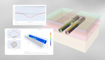
Enable true ground-informed design in Civil 3D

Events

19th European Conference on Soil Mechanics and Geotechnical Engineering, Istanbul, Türkiye
The 10th International Congress on Environmental Geotechnics

11th European Conference on Numerical Methods in Geotechnical Engineering

1st International Conference on Sustainability in Geotechnical Engineering (ICSGE 2027)

The 4th International Conference on Press-in Engineering 2027 (ICPE2027)

International Symposium on Cone Penetration Testing (CPT'27)

Rocscience International Conference 2027: Geotechnics, Structures & Hydro in the Age of AI
IS-GI Lyon 2027: International Symposium on Ground Improvement