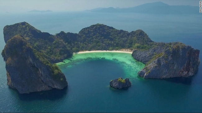
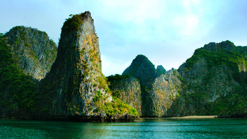
It's a hidden place of untamed beauty along Myanmar's southern coastline. Among the most compelling images of its tropical islands are sheer limestone cliffs rising, sometimes, hundreds of metres from the sea, holed with caves and fringed with jungle. But how were these scenic tropical shorelines formed over the ages?
Mergui or Myeik Archipelago - as the locals would call it – comprises about 800 islands, distributed along approximately 600 km of Myanmar's Andaman coast. It extends from Mali Island north of Myeik, to Za Det Gyi Island in Kawthoung, in the southern Tanintharyi coastal region of Myanmar.
The topography of Tanintharyi coast is greatly influenced by tectonic movement and volcanic activity resulting from the docking of the Indian tectonic plate with the Eurasian plate in the early Miocene. The twisting of the Eurasian plate as the Indian plate dragged its margins northwards formed many rocky shorelines and the rocky headlands and capes jutting out into the sea. The region's granitic islands began as intrusions of hot magma that rose through weak spots in the Earth's crust hundreds of million years ago, working their way through thick layers of sedimentary rock laid down at least 100 million years earlier still.
Over millions of years, a ceaseless rain of marine precipitates, much of it consisting of the shells of planktonic sea creatures, gradually came to deposit enough calcium carbonate that the pressure of its own weight formed a bed of limestone hundreds of metres thick. After more millions of years, movements in the Earth's crust began to exert titanic pressures, and the limestone, being inelastic, didn't bend or fold — instead, great blocks sheered away from one another, some of them thrusting up while others sank beneath the surface. The Mergui Archipelago itself is composed mainly of metamorphic rocks of the Mergui Series, following tectonic lines north to south. Outer islands, like those of northern Thailand, are mostly granitic, whereas inshore islands are often composed of limestone.
Nature still had the finishing touches to put to this masterpiece, however, with a series of ice ages. Over even more millions of years the ice caps expanded and contracted, alternately taking up and releasing enormous quantities of seawater so that sea levels rose and fell by more than 150 metres.
At different periods in geological history, then, wind, waves and currents added their work to shaping the Mergui Archipelago islands. Rainwater, meanwhile, in combination with decaying organic matter, was producing acids that dissolved the limestone to create caves, many of which exit high on the cliffs.
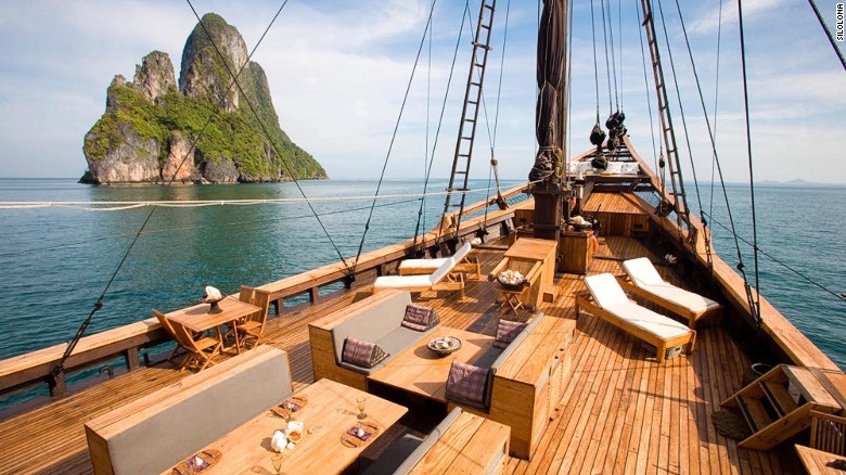
Apart from the sparkling blue waters, thus, it's these granite and limestone geologies that provide most of the conditions for enjoying a whole range of activities, when visiting the Mergui Archipelago islands. Their exotic submarine panoramas are favoured by scuba divers from around the world, while caves and collapsed cave systems (hongs) are considered perfect for seakayaking.
Image Gallery credits: CNN, We Want Adventure
Sources: The Andaman Sea Rocks (by Collin Piprell),, CNN
Image Gallery


Want to read more like this story?

World’s first artificial energy island to be constructed in the North Sea
Feb, 28, 2023 | NewsThe construction contract for the world’s first artificial energy island was recently awarded to a...

Video of new Japanese island formed by volcanic eruption
Nov, 21, 2013 | NewsA new island was formed south of Japan after the eruption of an undersea volcano, only two months af...

Geological paradox found in African island
Mar, 21, 2019 | NewsScientists have made a very mysterious discovery about the rock formations on Anjouan island, locate...

New island off Japan can be seen forming from underwater volcanic eruption
Oct, 21, 2023 | NewsA new island can be seen being created from an underwater volcano erupting off the coast of Japan,...
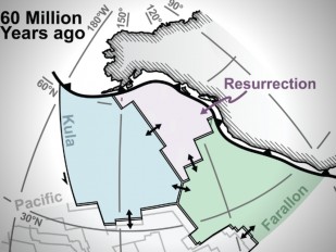
Finding a missing tectonic plate
Oct, 19, 2020 | NewsScientists from the University of Houston have managed to detect signs of a controversial tectonic...

New Zealand volcano eruption: At least 5 dead
Dec, 09, 2019 | NewsAt least 5 people were reported dead after a volcano erupted in New Zealand's White Island on Monda...

Pakistan earthquake forms a new island
Sep, 24, 2013 | NewsAn earthquake (Mw 7.7) occurred on Tuesday in south-central Pakistan resulting in 400 deaths, many i...

Kefalonia, Greece: Magnitude 5.4 Earthquake hits the island
Sep, 08, 2022 | NewsA magnitude 5.4 earthquake hit between the islands of Kefalonia and Zakynthos in the Ionian Sea on...

Study on the East African Rift System: Madagascar will split into pieces
Sep, 23, 2020 | NewsAccording to a new study on the kinematics of the East African Rift System, much of the continental...
On This Day
April 19th 1999
READ MORE
Trending

Earthquakes can trigger seismic events on the opposite side of Earth

South Asia’s first underwater tunnel inaugurated in Bangladesh

Richat: The Giant Blue Eye of Africa
Fulgurite: A rare phenomenon

Rockfall in South African gold mine: 4 workers dead


